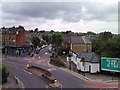
Area Overview for N4 3LT
Photos of N4 3LT


Area Information
Living in N4 3LT offers a compact, residential experience shaped by its small cluster of homes and proximity to London’s transport networks. With a population of 1,913, the area is characterised by a mature demographic, with residents predominantly aged 30–64. The community feels tight-knit, with a focus on practical living rather than sprawling development. Daily life here is defined by accessibility to key services and transport links, making it a convenient base for those working in central London or nearby areas. The area’s low flood risk and absence of environmental constraints like protected woodlands or AONBs suggest a stable, low-maintenance environment. However, a medium crime risk score of 52 means residents should remain vigilant with standard security measures. N4 3LT’s appeal lies in its balance of quiet residential living and connectivity, though its small size means it’s best suited for those prioritising ease of access over expansive space.
- Area Type
- Postcode
- Area Size
- Not available
- Population
- 1913
- Population Density
- 14581 people/km²
N4 3LT’s property market is defined by its high proportion of rented flats, with only 34% of homes owned by residents. This suggests a rental-heavy area, likely influenced by the small size of the postcode and the dominance of flats over larger properties. The scarcity of owner-occupied homes may indicate limited opportunities for long-term investment or family home purchases, though the area’s proximity to transport links could make it attractive to commuters. The lack of data on property prices or development plans means buyers should consider the area’s limited scope for expansion. For those seeking a flat in a convenient location, N4 3LT offers accessibility to nearby amenities, but its small size and rental focus may not suit those prioritising property ownership.
House Prices in N4 3LT
No properties found in this postcode.
Energy Efficiency in N4 3LT
Residents of N4 3LT have access to a range of amenities within practical reach, including retail options like Tesco Hornsey, Tesco Stroud, and Sainsburys London. The area’s transport links connect it to major hubs such as Finsbury Park and Arsenal stations, facilitating easy access to shopping, leisure, and employment opportunities. Ferry services like Camden Lock Waterbus and Blackfriars Pier provide scenic travel options, while bus routes from Whipps Cross and London Victoria Coach Station cater to longer journeys. The mix of retail, transport, and connectivity options ensures a convenient lifestyle, though the area’s small size means it relies heavily on nearby districts for more extensive facilities. The presence of multiple transport modes and retail outlets enhances daily life, offering both practicality and variety.
Amenities
Schools
The nearest school to N4 3LT is St Mark’s CofE Primary School, which holds a ‘good’ Ofsted rating. As a primary school, it serves the local community’s younger residents, though no secondary schools are listed in the data. The presence of a single primary school with a positive rating suggests a basic educational offering for families with children aged 4–11. However, parents seeking secondary education may need to look further afield, as no secondary schools are mentioned. The school’s ‘good’ rating implies acceptable standards, but the absence of additional educational facilities in the area could be a consideration for families requiring more comprehensive schooling options.
| Rank | School | Type | Entry gender | Ages |
|---|
Explore more schools in this area
Go to Schools tabDemographics
The community in N4 3LT is predominantly composed of adults aged 30–64, with a median age of 47. This suggests a population of working-age individuals and families, though the 34% home ownership rate indicates that a significant portion of residents rent their homes. The accommodation type is almost entirely flats, reflecting a lack of larger properties or detached housing. The predominant ethnic group is White, though no specific diversity statistics are provided. The age profile implies a stable, established community, but the low home ownership rate may point to a rental market dominated by private landlords or housing associations. With no data on deprivation levels, it’s unclear how this affects quality of life, but the absence of environmental constraints and low flood risk suggests a practical, if unremarkable, living environment.
Household Size
Accommodation Type
Tenure
Ethnic Group
Religion
Household Composition
Age
Household Deprivation
NS-SEC
Explore more demographic insights in this area
Go to Demographics tabPlanning
Planning Constraints
- Flood RiskPremium
- Ramsar Wetland SitesPremium
- Area of Outstanding Natural BeautyPremium
- Protected Nature ReservePremium
- Protected WoodlandPremium