Area Overview for N4 1AX
Photos of N4 1AX

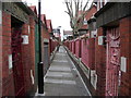

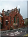
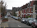
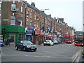
100 photos from this area
Area Information
Key information about the N4 1AX including its size, population, and administrative classification.
- Area Type
- Postcode
- Area Size
- 8636 m²
- Population
- 1761
- Population Density
- 10884 people/km²
House Prices in N4 1AX
92
Properties
£693,000
Average Sold Price
£115,000
Lowest Price
£1,150,000
Highest Price
Showing 92 properties
| Address | Type | Beds | Baths | Last Sale Price | Last Sale Date | |
|---|---|---|---|---|---|---|
| 61 Pemberton Road, Hornsey, London, N4 1AX | Terraced | 5 | 2 | £1,075,000 | Nov 2022 | |
| 23 Pemberton Road, Hornsey, London, N4 1AX | house | - | - | £985,000 | Jan 2022 | |
| 57 Pemberton Road, Hornsey, London, N4 1AX | house | 4 | 1 | £1,150,000 | Aug 2021 | |
| 43 Pemberton Road, Hornsey, London, N4 1AX | Terraced | 3 | 2 | £892,000 | Mar 2016 | |
| 73 Pemberton Road, Hornsey, London, N4 1AX | Terraced | 3 | 1 | £740,000 | Dec 2013 | |
| 47 Pemberton Road, Hornsey, London, N4 1AX | house | 4 | - | £535,000 | Aug 2010 | |
| 41 Pemberton Road, Hornsey, London, N4 1AX | Flat | 1 | 1 | £520,000 | Apr 2008 | |
| 13 Pemberton Road, Hornsey, London, N4 1AX | house | - | - | £225,000 | Jan 2001 | |
| 51 Pemberton Road, Hornsey, London, N4 1AX | Flat | 1 | 1 | £115,000 | Jan 1996 | |
| Flat B, 5 Pemberton Road, Hornsey, London, N4 1AX | Flat | 2 | 1 | - | - |
Page 1 of 10
Energy Efficiency in N4 1AX
Amenities
Schools
| Rank | School | Type | Entry gender | Ages |
|---|
Explore more schools in this area
Go to Schools tabDemographics
Household Size
Family (3-5 people)
most common
Accommodation Type
Flats
most common
Tenure
45
majority
Ethnic Group
White
most common
Religion
N/A
most common
Household Composition
N/A
most common
Age
47
median
Adults (30-64 years)
most common
Household Deprivation
N/A
with no deprivation
NS-SEC
47
in Lower managerial occupations
Explore more demographic insights in this area
Go to Demographics tabPlanning
Planning Constraints
- Flood RiskPremium
- Ramsar Wetland SitesPremium
- Area of Outstanding Natural BeautyPremium
- Protected Nature ReservePremium
- Protected WoodlandPremium