Area Overview for N3 1RQ
Photos of N3 1RQ


Area Information
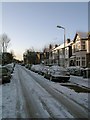
N3 1RQ is a small residential postcode area in England, home to 1,785 people. It forms a compact cluster of properties, typically flats, serving a community with a median age of 47. The area is defined by its proximity to transport hubs and retail centres, making it a practical choice for those prioritising connectivity. Daily life here is shaped by the presence of nearby supermarkets like Tesco Finchley and Sainsburys Finchley Regents, as well as accessible rail and metro stations. The area’s small size means it is tightly integrated with surrounding districts, offering a blend of urban convenience and residential calm. While it lacks natural landscapes or protected sites, its strategic location near Finchley Central Station and Mill Hill East Station ensures easy access to London’s broader transport network. For buyers, N3 1RQ represents a niche market where property availability is limited, and the character of the neighbourhood is defined by its mature population and established infrastructure.
- Area Type
- Postcode
- Area Size
- Not available
- Population
- 1785
- Population Density
- 7979 people/km²
The property market in N3 1RQ is characterised by a low home ownership rate of 39%, suggesting that the majority of properties are rented. Flats dominate the accommodation type, which aligns with the area’s small footprint and likely density. This dynamic indicates a rental-focused market rather than a strong owner-occupied presence. For buyers, this means competition for the limited available properties, particularly flats, which may be more suited to individuals or couples rather than larger families. The area’s proximity to transport links like Finchley Central Station and Mill Hill East Station could make it attractive to commuters, though the small size of N3 1RQ means the immediate surroundings are key to finding additional options. Buyers should consider the practicality of flats in this context, balancing affordability with the constraints of space and the need for nearby amenities.
House Prices in N3 1RQ
No properties found in this postcode.
Energy Efficiency in N3 1RQ
Living in N3 1RQ offers access to a range of amenities within practical reach. Retail options include major supermarkets like Tesco Finchley, Sainsburys Finchley Regents, and Waitrose Little, ensuring daily shopping needs are met. Transport links are extensive, with metro stations such as Finchley Central and rail services at Mill Hill East and New Southgate providing easy access to London’s transport network. Ferry stops like Camden Lock Waterbus and London Zoo Waterbus Stop offer alternative routes, though they are better suited for leisure trips. The area’s proximity to these facilities creates a convenient lifestyle, reducing the need for long commutes. While there are no notable parks or green spaces mentioned, the availability of retail, transport, and water-based mobility options suggests a community focused on accessibility and practicality over expansive natural landscapes.
Amenities
Schools
| Rank | School | Type | Entry gender | Ages |
|---|
Explore more schools in this area
Go to Schools tabDemographics
The population of N3 1RQ is predominantly adults aged 30–64, reflecting a mature community with a median age of 47. Home ownership here is relatively low, with only 39% of residents owning their homes. The majority of properties are flats, indicating a housing stock suited to smaller households or those prioritising rental flexibility. The predominant ethnic group is White, though no specific diversity statistics are provided. This demographic profile suggests a stable, long-term resident base with limited turnover. The absence of data on deprivation or income levels means the quality of life cannot be fully assessed, but the age range implies a community with established careers and family structures. The area’s compact size and focus on flats may appeal to professionals or retirees seeking manageable living spaces without the complexities of larger homes.
Household Size
Accommodation Type
Tenure
Ethnic Group
Religion
Household Composition
Age
Household Deprivation
NS-SEC
Explore more demographic insights in this area
Go to Demographics tabPlanning
Planning Constraints
- Flood RiskPremium
- Ramsar Wetland SitesPremium
- Area of Outstanding Natural BeautyPremium
- Protected Nature ReservePremium
- Protected WoodlandPremium