Area Overview for N3 1BQ
Photos of N3 1BQ


Area Information
Living in N3 1BQ means inhabiting a tightly packed residential cluster in north London, where 2124 people reside across just 2296 square metres. This high population density creates a compact, urban environment, with homes predominantly as flats rather than standalone properties. The area’s demographic profile skews towards adults aged 30–64, with a median age of 47, suggesting a community of established professionals and families. Daily life here is shaped by proximity to transport hubs and retail, with nearby schools and amenities within practical reach. The postcode’s small size means residents are likely to interact frequently with their immediate neighbours, fostering a close-knit atmosphere. While the area lacks natural landscapes, its strategic location offers access to London’s broader infrastructure, including major rail lines and shopping centres. For those prioritising convenience over space, N3 1BQ provides a mix of practicality and connectivity, though the density may feel restrictive for those seeking larger homes or private outdoor areas.
- Area Type
- Postcode
- Area Size
- 2296 m²
- Population
- 2124
- Population Density
- 8641 people/km²
The property market in N3 1BQ is characterised by a low home ownership rate of 33%, indicating that the area is primarily a rental market. With flats as the dominant accommodation type, the housing stock is suited to those prioritising convenience over space. This compact postcode’s limited size means property availability is constrained, and buyers may need to consider nearby areas for more options. The high population density suggests that demand for rental properties is likely to remain steady, though the small footprint of N3 1BQ itself may not offer significant scope for property investment. For buyers, the focus should be on proximity to transport and amenities rather than the size of individual properties. The area’s appeal lies in its accessibility, but its small size means that expansion or development is unlikely to be a feature of the local property market.
House Prices in N3 1BQ
No properties found in this postcode.
Energy Efficiency in N3 1BQ
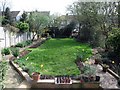
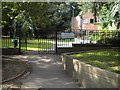
Residents of N3 1BQ benefit from a range of amenities within practical reach, including retail outlets such as Sainsburys Finchley Regents, Waitrose Little, and Tesco Finchley. These stores provide convenient access to groceries and daily essentials, reducing the need for long trips. The area’s transport links also facilitate leisure activities, with ferry stops like Camden Lock Waterbus and Little Venice Waterbus Stop offering scenic routes. Nearby stations such as Finchley Central and Mill Hill East provide connections to broader London, enabling easy access to cultural or recreational opportunities. While the area’s compact nature limits private green spaces, the proximity to transport and retail ensures a lifestyle focused on convenience and connectivity. The mix of shops, dining, and transport options supports a dynamic daily routine, though the lack of larger parks or recreational areas may be a drawback for those seeking more outdoor space.
Amenities
Schools
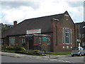
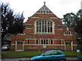
Residents of N3 1BQ have access to a range of schools, including Pardes House Primary School, which operates as both an independent institution with a ‘good’ Ofsted rating and a primary school with the same rating. Nearby, Pardes House Grammar School is an independent school with a ‘satisfactory’ rating. This mix of school types offers families flexibility, whether they prefer state or private education. The presence of multiple schools in the area suggests a focus on education, though the ratings indicate that while some institutions perform well, others may require closer scrutiny. For parents, the proximity of these schools is a significant advantage, reducing commuting times and allowing for a more integrated family life. However, the ‘satisfactory’ rating at the grammar school may prompt further investigation into its performance and facilities.
| Rank | School | Type | Entry gender | Ages |
|---|
Explore more schools in this area
Go to Schools tabDemographics
The community in N3 1BQ is predominantly composed of adults aged 30–64, with a median age of 47. This suggests a population of middle-aged individuals, likely balancing careers with family life. Home ownership rates are low at 33%, indicating that most residents rent their properties, which is typical in high-density urban areas. The accommodation type is almost exclusively flats, reflecting the area’s compact footprint. The predominant ethnic group is White, though specific data on diversity or deprivation is not provided. The population density of 925,141 people per square kilometre is exceptionally high, which may influence living conditions, such as limited private outdoor space and potential strain on shared resources. For those considering N3 1BQ, this demographic profile suggests a mature, stable community with a focus on proximity to services rather than expansive living spaces.
Household Size
Accommodation Type
Tenure
Ethnic Group
Religion
Household Composition
Age
Household Deprivation
NS-SEC
Explore more demographic insights in this area
Go to Demographics tabPlanning
Planning Constraints
- Flood RiskPremium
- Ramsar Wetland SitesPremium
- Area of Outstanding Natural BeautyPremium
- Protected Nature ReservePremium
- Protected WoodlandPremium