Area Overview for N22 8YX
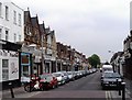
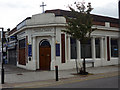
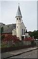
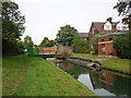
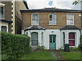
Photos of N22 8YX


Area Information
N22 8YX is a compact postcode area in England, covering 9,015 square metres and home to 1,927 residents. Its high population density of 213,759 people per square kilometre reflects a tightly knit residential cluster, likely centred around a mix of older housing stock and community spaces. The area’s small size means amenities and services are closely grouped, making daily life efficient for residents. With a median age of 47 and a population skewed toward adults aged 30–64, the community is mature and stable, with a strong presence of families and long-term residents. The predominance of flats suggests a mix of purpose-built housing and conversions, which may appeal to those seeking urban living with limited space. While the area lacks natural or protected landscapes, its proximity to transport hubs and schools positions it as a practical choice for commuters and families. The high broadband score of 90 and mobile coverage of 85 ensure reliable digital connectivity, supporting both work and leisure. For buyers, N22 8YX offers a blend of affordability, convenience, and accessibility, though its small footprint means competition for properties may be keen.
- Area Type
- Postcode
- Area Size
- 9015 m²
- Population
- 1927
- Population Density
- 6052 people/km²
N22 8YX is a flat-dominated area, with no data indicating the presence of detached or semi-detached homes. The 32% home ownership rate suggests that most properties are rented, likely through private landlords or housing associations. This dynamic positions the area as a rental market rather than a buyer’s market, with limited opportunities for owner-occupation. The small area size means housing stock is finite, and properties may be older, with potential for renovation or conversion. Buyers should consider the practicality of flats in a high-density zone, where space is constrained but proximity to transport and services is a plus. For those seeking to purchase, the area’s compact nature may require looking beyond immediate surroundings for larger properties. The flat-centric market also implies a focus on affordability, though competition for available units is likely.
House Prices in N22 8YX
Showing 1 properties
| Address | Type | Beds | Baths | Last Sale Price | Last Sale Date | |
|---|---|---|---|---|---|---|
| George Meehan House, Woodside Park, High Road, Wood Green, London, N22 8YX | Office | - | - | - | - |
Energy Efficiency in N22 8YX
N22 8YX’s proximity to retail hubs like Tesco Wood, Sainsburys London, and Tesco Wood ensures easy access to shopping and daily necessities. The area’s transport links also grant residents access to broader leisure opportunities, from the cultural attractions of Alexandra Palace to the natural spaces near London Zoo. The presence of multiple bus routes and rail stations means residents can reach parks, restaurants, and entertainment venues across North London swiftly. While the data does not specify local parks or dining options, the density of amenities suggests a well-served community. The combination of retail, transport, and nearby green spaces creates a lifestyle that balances convenience with accessibility, making daily life practical for families and professionals alike.
Amenities
Schools
N22 8YX is served by several primary schools, including Earlham Junior School, Earlham Infant School, and St Thomas More Catholic School, which holds a ‘good’ Ofsted rating. A second St Thomas More Catholic School operates as an academy with an ‘outstanding’ rating, offering a higher standard of education. The presence of both state and academy schools provides families with options, though the data does not indicate secondary schools in the immediate area. The concentration of primary schools suggests the area is family-friendly, with a focus on early education. For parents, the ‘outstanding’ academy may be a draw, though reliance on nearby schools for secondary education could necessitate commuting. The mix of school types reflects a balance between public and private-sector provision, though no data on pupil numbers or performance metrics is available.
| Rank | School | Type | Entry gender | Ages |
|---|
Explore more schools in this area
Go to Schools tabDemographics
The population of N22 8YX is predominantly adults aged 30–64, with a median age of 47. This suggests a community of established professionals, families, and retirees, rather than a younger demographic. Home ownership is relatively low at 32%, indicating that most residents are renters, which may reflect the area’s history as a mix of social housing and private flats. The accommodation type is exclusively flats, a common feature in high-density urban areas. The predominant ethnic group is White, though no specific data on diversity or deprivation is provided. The age profile and housing stock suggest a stable, long-term resident base, with limited turnover. For buyers, this demographic profile means a focus on mature properties rather than new builds, and a market that prioritises convenience over luxury. The lack of data on deprivation or income levels means quality of life factors beyond housing stock must be inferred from nearby amenities and transport links.
Household Size
Accommodation Type
Tenure
Ethnic Group
Religion
Household Composition
Age
Household Deprivation
NS-SEC
Explore more demographic insights in this area
Go to Demographics tabPlanning
Planning Constraints
- Flood RiskPremium
- Ramsar Wetland SitesPremium
- Area of Outstanding Natural BeautyPremium
- Protected Nature ReservePremium
- Protected WoodlandPremium