Area Overview for N22 8DW
Photos of N22 8DW
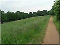
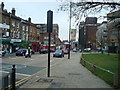
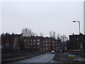
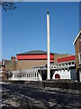
100 photos from this area
Area Information
Key information about the N22 8DW including its size, population, and administrative classification.
- Area Type
- Postcode
- Area Size
- 1.5 hectares
- Population
- 1713
- Population Density
- 8232 people/km²
House Prices in N22 8DW
35
Properties
£187,374
Average Sold Price
£86,000
Lowest Price
£425,000
Highest Price
Showing 35 properties
| Address | Type | Beds | Baths | Last Sale Price | Last Sale Date | |
|---|---|---|---|---|---|---|
| 48 Partridge Way, Wood Green, London, N22 8DW | Terraced | 3 | 1 | £425,000 | Jun 2021 | |
| 38 Partridge Way, Wood Green, London, N22 8DW | Terraced | 1 | 1 | £150,000 | Feb 2015 | |
| 68 Partridge Way, Wood Green, London, N22 8DW | Terraced | 3 | 1 | £200,000 | Nov 2012 | |
| 14 Partridge Way, Wood Green, London, N22 8DW | house | - | - | £245,000 | May 2007 | |
| 30 Partridge Way, Wood Green, London, N22 8DW | Terraced | - | - | £138,000 | Oct 2001 | |
| 2 Partridge Way, Wood Green, London, N22 8DW | Terraced | 3 | 1 | £135,000 | Aug 2001 | |
| 18 Partridge Way, Wood Green, London, N22 8DW | Terraced | - | - | £119,995 | Mar 2000 | |
| 46 Partridge Way, Wood Green, London, N22 8DW | Terraced | - | - | £86,000 | Apr 1999 | |
| 4 Partridge Way, Wood Green, London, N22 8DW | Retail | 1 | 1 | - | - | |
| 34 Partridge Way, Wood Green, London, N22 8DW | Terraced | 3 | 1 | - | - |
Page 1 of 4
Energy Efficiency in N22 8DW
Amenities
Schools
| Rank | School | Type | Entry gender | Ages |
|---|
Explore more schools in this area
Go to Schools tabDemographics
Household Size
One person
most common
Accommodation Type
Flats
most common
Tenure
37
majority
Ethnic Group
White
most common
Religion
N/A
most common
Household Composition
N/A
most common
Age
47
median
Adults (30-64 years)
most common
Household Deprivation
N/A
with no deprivation
NS-SEC
34
in Lower managerial occupations
Explore more demographic insights in this area
Go to Demographics tabPlanning
Planning Constraints
- Flood RiskPremium
- Ramsar Wetland SitesPremium
- Area of Outstanding Natural BeautyPremium
- Protected Nature ReservePremium
- Protected WoodlandPremium