Area Overview for N22 6SG
Photos of N22 6SG
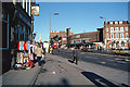
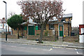
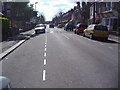
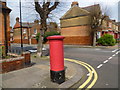
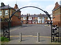
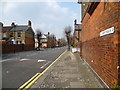
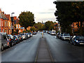
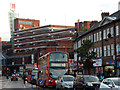
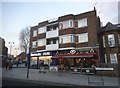
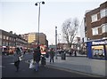
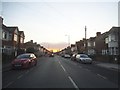
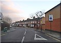
100 photos from this area
Area Information
Key information about the N22 6SG including its size, population, and administrative classification.
- Area Type
- Postcode
- Area Size
- 6261 m²
- Population
- 1430
- Population Density
- 13000 people/km²
House Prices in N22 6SG
44
Properties
£379,744
Average Sold Price
£114,000
Lowest Price
£830,000
Highest Price
Showing 44 properties
| Address | Type | Beds | Baths | Last Sale Price | Last Sale Date | |
|---|---|---|---|---|---|---|
| 37 Willingdon Road, Wood Green, London, N22 6SG | Terraced | 5 | 2 | £830,000 | Dec 2019 | |
| 41 Willingdon Road, Wood Green, London, N22 6SG | Terraced | 3 | 2 | £615,000 | Nov 2018 | |
| 15A Willingdon Road, Wood Green, London, N22 6SG | Terraced | 3 | 2 | £380,000 | Apr 2013 | |
| 19 Willingdon Road, Wood Green, London, N22 6SG | Terraced | 4 | - | £340,000 | Apr 2008 | |
| 1 Willingdon Road, Wood Green, London, N22 6SG | Flat | - | 1 | £390,000 | Jun 2007 | |
| 11 Willingdon Road, Wood Green, London, N22 6SG | Terraced | 3 | 2 | £250,000 | Nov 2003 | |
| 5 Willingdon Road, Wood Green, London, N22 6SG | Terraced | 7 | 1 | £118,950 | Jun 1999 | |
| 17 Willingdon Road, Wood Green, London, N22 6SG | Terraced | - | - | £114,000 | Jun 1997 | |
| Ground Floor Flat A, 43 Willingdon Road, Wood Green, London, N22 6SG | house | - | - | - | - | |
| Flat B, 43 Willingdon Road, Wood Green, London, N22 6SG | Flat | - | - | - | - |
Page 1 of 5
Energy Efficiency in N22 6SG
Amenities
Schools
| Rank | School | Type | Entry gender | Ages |
|---|
Explore more schools in this area
Go to Schools tabDemographics
Household Size
Family (3-5 people)
most common
Accommodation Type
Houses
most common
Tenure
38
majority
Ethnic Group
White
most common
Religion
N/A
most common
Household Composition
N/A
most common
Age
47
median
Adults (30-64 years)
most common
Household Deprivation
N/A
with no deprivation
NS-SEC
28
in Lower managerial occupations
Explore more demographic insights in this area
Go to Demographics tabPlanning
Planning Constraints
- Flood RiskPremium
- Ramsar Wetland SitesPremium
- Area of Outstanding Natural BeautyPremium
- Protected Nature ReservePremium
- Protected WoodlandPremium