Area Overview for N22 6JG
Photos of N22 6JG
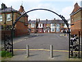
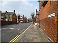
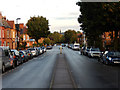
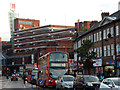
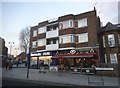
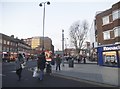
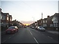
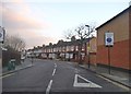
100 photos from this area
Area Information
Key information about the N22 6JG including its size, population, and administrative classification.
- Area Type
- Postcode
- Area Size
- 7391 m²
- Population
- 1802
- Population Density
- 14674 people/km²
House Prices in N22 6JG
62
Properties
£369,999
Average Sold Price
£102,500
Lowest Price
£700,000
Highest Price
Showing 62 properties
| Address | Type | Beds | Baths | Last Sale Price | Last Sale Date | |
|---|---|---|---|---|---|---|
| 142 Lymington Avenue, Wood Green, London, N22 6JG | Terraced | 3 | 1 | £425,000 | Dec 2023 | |
| 138 Lymington Avenue, Wood Green, London, N22 6JG | Terraced | 4 | 1 | £550,000 | Oct 2022 | |
| 158 Lymington Avenue, Wood Green, London, N22 6JG | Terraced | 3 | 1 | £510,000 | Mar 2019 | |
| 98 Lymington Avenue, Wood Green, London, N22 6JG | Terraced | 3 | 2 | £490,000 | Nov 2018 | |
| 90 Lymington Avenue, Wood Green, London, N22 6JG | Terraced | 3 | 1 | £565,000 | Sep 2018 | |
| 88 Lymington Avenue, Wood Green, London, N22 6JG | Terraced | 3 | 1 | £599,950 | Feb 2018 | |
| 82 Lymington Avenue, Wood Green, London, N22 6JG | Terraced | 3 | 1 | £620,000 | Sep 2017 | |
| 108 Lymington Avenue, Wood Green, London, N22 6JG | Terraced | 5 | 5 | £700,000 | Jan 2017 | |
| 154 Lymington Avenue, Wood Green, London, N22 6JG | Terraced | 3 | - | £504,500 | Sep 2015 | |
| 78 Lymington Avenue, Wood Green, London, N22 6JG | Terraced | 3 | 1 | £477,525 | Apr 2014 |
Page 1 of 7
Energy Efficiency in N22 6JG
Amenities
Schools
| Rank | School | Type | Entry gender | Ages |
|---|
Explore more schools in this area
Go to Schools tabDemographics
Household Size
Family (3-5 people)
most common
Accommodation Type
Houses
most common
Tenure
29
majority
Ethnic Group
White
most common
Religion
N/A
most common
Household Composition
N/A
most common
Age
47
median
Adults (30-64 years)
most common
Household Deprivation
N/A
with no deprivation
NS-SEC
24
in Lower managerial occupations
Explore more demographic insights in this area
Go to Demographics tabPlanning
Planning Constraints
- Flood RiskPremium
- Ramsar Wetland SitesPremium
- Area of Outstanding Natural BeautyPremium
- Protected Nature ReservePremium
- Protected WoodlandPremium