Area Overview for N22 5LF
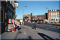
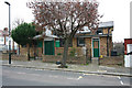
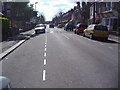
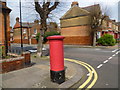
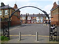
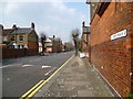
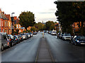
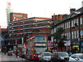
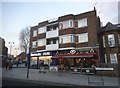
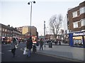
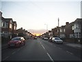
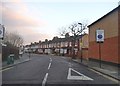
Photos of N22 5LF
Area Information
Living in N22 5LF means inhabiting a compact, densely populated residential cluster in England. The area covers just 5,547 square metres, housing 2,020 people, resulting in a population density of 364,179 per square kilometre. This suggests a tightly knit community, though the small size may limit space for expansion. The area’s character is shaped by its demographics: the median age is 47, with adults aged 30–64 forming the largest group. Most residents are renters, with only 20% owning their homes, and the accommodation is predominantly flats. This hints at a practical, urban layout suited to those prioritising convenience over space. While the area lacks natural or protected landscapes, its proximity to transport hubs and retail amenities makes it appealing for commuters. However, the high density and limited green space may challenge those seeking a quieter, more spread-out environment. For buyers, the small footprint means the surrounding areas are likely to be critical for finding additional options.
- Area Type
- Postcode
- Area Size
- 5547 m²
- Population
- 2020
- Population Density
- 12769 people/km²
The property market in N22 5LF is characterised by a low home ownership rate—just 20% of residents own their homes. This suggests the area is primarily a rental market, with flats being the dominant accommodation type. The compact size of the postcode (5,547 m²) means housing stock is likely limited, with little scope for new developments. For buyers, this presents a challenge: the area itself may not offer many owner-occupied properties, and the immediate surroundings are likely to be key for finding options. Flats in such a densely populated area may prioritise efficiency over space, appealing to those who value proximity to transport and amenities over larger living areas. However, the small footprint and high density could also mean competition for available properties, particularly for those seeking long-term ownership.
House Prices in N22 5LF
No properties found in this postcode.
Energy Efficiency in N22 5LF
Residents of N22 5LF have access to a range of nearby amenities that support daily life. Retail options include major supermarkets like Tesco Wood, Sainsburys London, and Morrisons High, ensuring convenience for shopping. The area is well-served by transport hubs, with metro stations such as Wood Green and Turnpike Lane, rail links to Alexandra Palace Station and Bowes Park, and ferry stops at Camden Lock and London Zoo. These connections facilitate both local and long-distance travel. While specific parks or leisure facilities are not detailed in the data, the proximity to transport and retail suggests a focus on urban living. The presence of multiple stations and ferry routes indicates a lifestyle centred on mobility, with opportunities for both commuting and leisurely travel.
Amenities
Schools
| Rank | School | Type | Entry gender | Ages |
|---|
Explore more schools in this area
Go to Schools tabDemographics
The community in N22 5LF is predominantly composed of adults aged 30–64, with a median age of 47. This suggests a mature population, likely with established careers and families. Home ownership is low, with only 20% of residents owning their properties, indicating a rental-heavy market. The accommodation type is flats, reflecting a preference for urban living or shared spaces. The predominant ethnic group is White, though specific data on diversity or deprivation is not provided. The high population density—364,179 people per square kilometre—suggests a compact, possibly mixed-use area where residents may rely on shared amenities. While this density can foster a sense of community, it may also contribute to congestion or limited private outdoor space. The age profile implies a stable, middle-aged demographic, which could influence local services and infrastructure needs.
Household Size
Accommodation Type
Tenure
Ethnic Group
Religion
Household Composition
Age
Household Deprivation
NS-SEC
Explore more demographic insights in this area
Go to Demographics tabPlanning
Planning Constraints
- Flood RiskPremium
- Ramsar Wetland SitesPremium
- Area of Outstanding Natural BeautyPremium
- Protected Nature ReservePremium
- Protected WoodlandPremium