Area Overview for N22 5HN
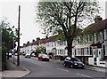
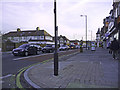
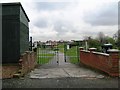
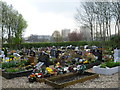
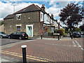
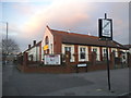
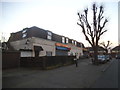
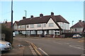
Photos of N22 5HN

Area Information
Living in N22 5HN means inhabiting a compact, densely populated residential cluster in England. The area covers just 1.3 hectares, yet it houses 1,927 people, resulting in a population density of 143,026 people per square kilometre. This high density reflects a tightly knit community, with most residents living in flats rather than detached homes. The area’s small size means amenities and services are closely grouped, making daily life efficient for those who prioritise convenience. N22 5HN is not a sprawling suburb but a focused postcode where proximity to schools, transport, and retail is a defining feature. The median age of 47 suggests a mature population, with adults aged 30–64 forming the largest demographic. For buyers, this area offers a snapshot of urban living: limited space but rich in connectivity, with a mix of local shops, transport hubs, and educational institutions within easy reach. Its character is shaped by its constraints—small area, high density—but also by the practicality of its layout, which caters to those who value accessibility over expansive living spaces.
- Area Type
- Postcode
- Area Size
- 1.3 hectares
- Population
- 1927
- Population Density
- 6052 people/km²
The property market in N22 5HN is defined by its small size and high density. With only 1.3 hectares of space, the area is not suited to large homes or detached properties. Instead, the accommodation type is predominantly flats, which dominate the housing stock. This suggests that the market is not primarily owner-occupied but rather geared towards rental properties. The home ownership rate of 32% underscores this, with the majority of residents likely to be tenants. For buyers, this means opportunities for purchase are limited, and the focus is on flats within a compact area. The immediate surroundings may offer more variety, but within N22 5HN itself, the housing options are constrained by space. Prospective buyers should consider that the market is not expansive, and properties available are likely to be smaller in size. The high density also means that the area is well-serviced by nearby amenities, which could be a selling point for those prioritising convenience over space.
House Prices in N22 5HN
Showing 2 properties
| Address | Type | Beds | Baths | Last Sale Price | Last Sale Date | |
|---|---|---|---|---|---|---|
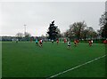
| Tennis Court, St Thomas More Catholic School, Glendale Avenue, Wood Green, London, N22 5HN | Leisure | - | - | - | - | |
| Tennis Pavilion, St Thomas More Catholic School, Glendale Avenue, Wood Green, London, N22 5HN | Leisure | - | - | - | - |
Energy Efficiency in N22 5HN
Residents of N22 5HN enjoy a lifestyle shaped by its proximity to retail, transport, and leisure facilities. The area is within practical reach of five retail outlets, including Tesco Wood and Sainsburys London, ensuring everyday shopping needs are met. Transport options are extensive, with five metro stations, five rail stations, and two ferry stops, including Camden Lock Waterbus and London Zoo Waterbus Stop. These connections facilitate both local and long-distance travel. For leisure, the nearby London Zoo Waterbus Stop suggests access to green spaces and cultural attractions. The presence of the Whipps Cross Bus Interchange adds to the area’s convenience, linking residents to broader networks. While the data does not specify parks or recreational areas, the density of amenities implies a focus on urban living with minimal reliance on private spaces. The mix of retail, transport, and ferry access creates a dynamic environment where daily life is efficient, with services and activities clustered closely together.
Amenities
Schools
Residents of N22 5HN have access to a range of primary schools, including Earlham Junior School, Earlham Infant School, St Thomas More Catholic School, and Earlham Primary School, which holds an Ofsted rating of ‘good’. A second St Thomas More Catholic School, designated as an academy, has an outstanding Ofsted rating. This mix of primary schools and an academy provides families with multiple educational options, from traditional state schools to academies with higher performance ratings. The presence of two schools with ‘good’ and one with ‘outstanding’ ratings suggests a generally strong educational environment. For families prioritising academic quality, the academy’s rating may be a key consideration. However, the concentration of primary schools in the area means that secondary education options are not listed here, requiring further research. The proximity of these schools to N22 5HN enhances the area’s appeal for households with children, offering convenience and a range of curricular approaches.
| Rank | School | Type | Entry gender | Ages |
|---|
Explore more schools in this area
Go to Schools tabDemographics
The community in N22 5HN is predominantly composed of adults aged 30–64, with a median age of 47. This suggests a population that is largely established, with fewer young families or retirees compared to other areas. Home ownership is relatively low at 32%, indicating that a majority of residents are likely to be renters. The accommodation type is predominantly flats, which aligns with the area’s high population density. The predominant ethnic group is White, reflecting a homogenous demographic profile. While specific data on deprivation is not provided, the combination of low home ownership and high density may imply a mix of social housing and private rentals. The absence of detailed diversity metrics means the community’s composition is not extensively characterised beyond the stated figures. For buyers, this suggests a market where owner-occupied properties are rare, and the housing stock is focused on smaller, shared spaces. The age profile also indicates a stable, long-term resident base, which may influence local services and amenities.
Household Size
Accommodation Type
Tenure
Ethnic Group
Religion
Household Composition
Age
Household Deprivation
NS-SEC
Explore more demographic insights in this area
Go to Demographics tabPlanning
Planning Constraints
- Flood RiskPremium
- Ramsar Wetland SitesPremium
- Area of Outstanding Natural BeautyPremium
- Protected Nature ReservePremium
- Protected WoodlandPremium