Area Overview for N22 5EL
Photos of N22 5EL
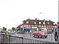


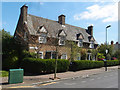


51 photos from this area
Area Information
Key information about the N22 5EL including its size, population, and administrative classification.
- Area Type
- Postcode
- Area Size
- 1.1 hectares
- Population
- 1454
- Population Density
- 8568 people/km²
House Prices in N22 5EL
57
Properties
£356,865
Average Sold Price
£28,500
Lowest Price
£697,000
Highest Price
Showing 57 properties
| Address | Type | Beds | Baths | Last Sale Price | Last Sale Date | |
|---|---|---|---|---|---|---|
| 16 Homecroft Road, Wood Green, London, N22 5EL | Terraced | 2 | 1 | £525,000 | Dec 2025 | |
| 37 Homecroft Road, Wood Green, London, N22 5EL | Terraced | 2 | 2 | £697,000 | Sep 2024 | |
| 25 Homecroft Road, Wood Green, London, N22 5EL | Terraced | 3 | 1 | £605,000 | Dec 2022 | |
| 29 Homecroft Road, Wood Green, London, N22 5EL | Terraced | 4 | - | £600,000 | May 2022 | |
| 31 Homecroft Road, Wood Green, London, N22 5EL | Terraced | 4 | 2 | £633,000 | Oct 2020 | |
| 39 Homecroft Road, Wood Green, London, N22 5EL | Terraced | 4 | 3 | £575,000 | Apr 2020 | |
| 50 Homecroft Road, Wood Green, London, N22 5EL | Terraced | 2 | 1 | £400,000 | Jul 2018 | |
| 36 Homecroft Road, Wood Green, London, N22 5EL | Terraced | 3 | 1 | £635,000 | Oct 2017 | |
| 34 Homecroft Road, Wood Green, London, N22 5EL | Terraced | 3 | 2 | £615,000 | Mar 2017 | |
| 10 Homecroft Road, Wood Green, London, N22 5EL | Terraced | 3 | 1 | £495,000 | Oct 2016 |
Page 1 of 6
Energy Efficiency in N22 5EL
Amenities
Schools
| Rank | School | Type | Entry gender | Ages |
|---|
Explore more schools in this area
Go to Schools tabDemographics
Household Size
Family (3-5 people)
most common
Accommodation Type
Houses
most common
Tenure
45
majority
Ethnic Group
White
most common
Religion
N/A
most common
Household Composition
N/A
most common
Age
47
median
Adults (30-64 years)
most common
Household Deprivation
N/A
with no deprivation
NS-SEC
23
in Lower managerial occupations
Explore more demographic insights in this area
Go to Demographics tabPlanning
Planning Constraints
- Flood RiskPremium
- Ramsar Wetland SitesPremium
- Area of Outstanding Natural BeautyPremium
- Protected Nature ReservePremium
- Protected WoodlandPremium