Area Overview for N22 5EA
Photos of N22 5EA
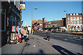
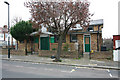
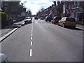
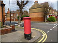
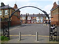
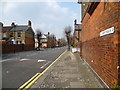
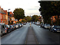
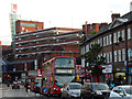
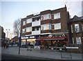
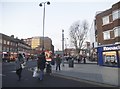
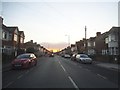
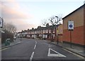
100 photos from this area
Area Information
Key information about the N22 5EA including its size, population, and administrative classification.
- Area Type
- Postcode
- Area Size
- 9864 m²
- Population
- 1454
- Population Density
- 8568 people/km²
House Prices in N22 5EA
49
Properties
£271,604
Average Sold Price
£67,500
Lowest Price
£685,000
Highest Price
Showing 49 properties
| Address | Type | Beds | Baths | Last Sale Price | Last Sale Date | |
|---|---|---|---|---|---|---|
| 21 Melrose Avenue, Wood Green, London, N22 5EA | Terraced | 3 | 2 | £673,632 | Nov 2023 | |
| 11 Melrose Avenue, Wood Green, London, N22 5EA | Terraced | 3 | 1 | £560,000 | Aug 2023 | |
| 41 Melrose Avenue, Wood Green, London, N22 5EA | Terraced | 4 | 2 | £685,000 | Aug 2018 | |
| 28 Melrose Avenue, Wood Green, London, N22 5EA | Terraced | 3 | - | £375,000 | Nov 2013 | |
| 10 Melrose Avenue, Wood Green, London, N22 5EA | Terraced | 3 | 2 | £335,000 | May 2013 | |
| 39 Melrose Avenue, Wood Green, London, N22 5EA | house | - | - | £340,000 | Oct 2012 | |
| 5 Melrose Avenue, Wood Green, London, N22 5EA | Terraced | 3 | 1 | £200,000 | Jul 2012 | |
| 13 Melrose Avenue, Wood Green, London, N22 5EA | house | 3 | - | £264,000 | Feb 2012 | |
| 40 Melrose Avenue, Wood Green, London, N22 5EA | house | 3 | - | £250,000 | Aug 2011 | |
| 36 Melrose Avenue, Wood Green, London, N22 5EA | house | - | - | £295,000 | Mar 2008 |
Page 1 of 5
Energy Efficiency in N22 5EA
Amenities
Schools
| Rank | School | Type | Entry gender | Ages |
|---|
Explore more schools in this area
Go to Schools tabDemographics
Household Size
Family (3-5 people)
most common
Accommodation Type
Houses
most common
Tenure
45
majority
Ethnic Group
White
most common
Religion
N/A
most common
Household Composition
N/A
most common
Age
47
median
Adults (30-64 years)
most common
Household Deprivation
N/A
with no deprivation
NS-SEC
23
in Lower managerial occupations
Explore more demographic insights in this area
Go to Demographics tabPlanning
Planning Constraints
- Flood RiskPremium
- Ramsar Wetland SitesPremium
- Area of Outstanding Natural BeautyPremium
- Protected Nature ReservePremium
- Protected WoodlandPremium