Area Overview for N22 4XS
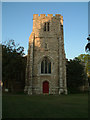
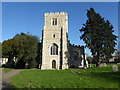
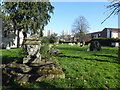
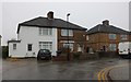
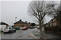
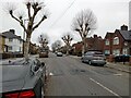
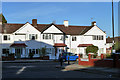
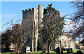
Photos of N22 4XS


Area Information
Living in N22 4XS offers a blend of quiet residential living and accessible urban connectivity. This small postcode area, home to around 1,731 residents, sits within a compact cluster of properties, creating a tight-knit community feel. The area’s proximity to multiple transport hubs, including rail and metro stations, ensures easy access to London’s broader network. Daily life here is shaped by a predominantly middle-aged population, with adults aged 30–64 forming the largest demographic group. The presence of family-friendly amenities, such as primary schools and retail outlets, supports a lifestyle that balances domestic comfort with practicality. While the area lacks large-scale commercial developments, its small size means residents can navigate local services on foot or by bike. The mix of homes, primarily owner-occupied, reflects a stable demographic with a focus on long-term residency. For those seeking a quieter alternative to central London, N22 4XS provides a base with reliable connectivity and a sense of local identity.
- Area Type
- Postcode
- Area Size
- Not available
- Population
- 1731
- Population Density
- 9030 people/km²
The property market in N22 4XS is characterised by a 43% home ownership rate, indicating a mix of owner-occupied homes and rental properties. The area’s accommodation type is predominantly houses, which are more common than flats or apartments. This suggests a residential profile suited to families or individuals seeking space and privacy, rather than a high-rise or student-focused market. Given the small size of the postcode area, the housing stock is likely limited, with properties concentrated around key transport links such as rail and metro stations. Buyers should consider that the lower home ownership rate may reflect a higher proportion of rental properties, potentially affecting availability for purchase. The presence of houses also implies a focus on long-term residency, with fewer short-term lettings or speculative investments. For those seeking a home, the area offers a stable, family-oriented environment but with a relatively modest selection of properties.
House Prices in N22 4XS
No properties found in this postcode.
Energy Efficiency in N22 4XS
The lifestyle in N22 4XS is defined by its proximity to essential amenities and a mix of retail and transport options. Local shops such as Lidl Lower, Asda Edmonton, and Iceland Edmonton cater to daily needs, while nearby stations like Edmonton Green and Bounds Green offer links to broader London. The area’s rail and metro connections ensure residents can access cultural, leisure, and employment opportunities beyond the immediate postcode. While the data does not specify parks or leisure facilities, the presence of multiple transport hubs suggests a balance between residential tranquillity and urban accessibility. The character of the area is shaped by its practicality—residents can combine convenience with a quieter, community-focused environment. The retail and transport options available support a lifestyle that prioritises ease of movement and self-sufficiency without the need for long commutes.
Amenities
Schools
The nearest school to N22 4XS is Latymer All Saints CofE Primary School, a primary institution with a ‘good’ Ofsted rating. This school serves the local community, offering education for younger children and contributing to the area’s family-friendly appeal. The absence of secondary schools in the data means families may need to travel further for secondary education, though the primary school’s quality provides a solid foundation for early learning. The single listed school suggests a focus on primary education within the area, which could be advantageous for parents prioritising convenience for younger children. However, those requiring secondary schooling may need to consider nearby districts or commute to larger educational hubs. The school’s rating indicates a satisfactory standard of teaching and facilities, aligning with the area’s overall practical, community-oriented character.
| Rank | School | Type | Entry gender | Ages |
|---|
Explore more schools in this area
Go to Schools tabDemographics
The population of N22 4XS is 1,731, with a median age of 47, indicating a mature demographic skewed toward adults aged 30–64. Home ownership sits at 43%, suggesting a balance between owner-occupied properties and rental units. The area is predominantly White, with no specific data provided on other ethnic groups. The accommodation type is primarily houses, reflecting a residential profile that contrasts with high-density urban areas. This age range and ownership level imply a community of established families and professionals, likely prioritising stability over transient living. The absence of detailed diversity metrics means the area’s cultural composition remains less defined, but the demographic data aligns with broader trends in suburban London. The median age also suggests a lower proportion of young families or students, which may influence local services and amenities.
Household Size
Accommodation Type
Tenure
Ethnic Group
Religion
Household Composition
Age
Household Deprivation
NS-SEC
Explore more demographic insights in this area
Go to Demographics tabPlanning
Planning Constraints
- Flood RiskPremium
- Ramsar Wetland SitesPremium
- Area of Outstanding Natural BeautyPremium
- Protected Nature ReservePremium
- Protected WoodlandPremium