Area Overview for N22 4HN
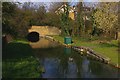
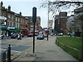
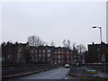
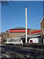
Photos of N22 4HN


Area Information
N22 4HN is a small residential postcode in England, home to 1530 residents living in a compact cluster of properties. The area’s character is defined by its proximity to transport networks and local amenities, making it a practical choice for commuters and families. With a median age of 47, the community is predominantly composed of adults aged 30–64, reflecting a stable, established population. Daily life here is shaped by the availability of nearby schools, retail outlets, and public transport links. The area’s small size means residents are close to essential services, though the limited population suggests a quiet, neighbourly atmosphere. While not a sprawling suburb, N22 4HN offers a balance of convenience and residential tranquillity. Its location near major transport hubs, such as Wood Green and Turnpike Lane stations, ensures easy access to London’s broader network. For those prioritising proximity to schools and shops, this postcode provides a functional base without the density of larger urban centres.
- Area Type
- Postcode
- Area Size
- Not available
- Population
- 1530
- Population Density
- 7810 people/km²
The property market in N22 4HN is characterised by a 48% home ownership rate, with flats being the primary accommodation type. This suggests a housing stock that caters to smaller households, couples, or single occupants rather than larger families. The prevalence of flats may indicate a focus on affordability and space efficiency, typical of urban or semi-urban areas. Given the small population and limited land area, the market is unlikely to be expansive, with properties concentrated in a compact cluster. For buyers, this means competition may be limited, but the supply of homes is also constrained. The 48% ownership rate implies that over half the housing stock is rented, potentially creating a rental market that could influence property values. Buyers should consider whether the area’s flat-dominated nature aligns with their long-term needs, particularly if family size or lifestyle preferences change.
House Prices in N22 4HN
No properties found in this postcode.
Energy Efficiency in N22 4HN
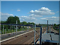
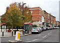
Living in N22 4HN offers access to a range of amenities within walking or short driving distance. Retail options include Morrisons High, Sainsburys London, and Iceland Wood, providing everyday shopping needs. The area’s transport links connect residents to leisure spots such as London Zoo and Camden Lock, accessible via waterbus routes. Parks and open spaces are not explicitly mentioned in the data, but the proximity to Alexandra Palace Station suggests nearby green spaces. The presence of multiple metro, rail, and ferry services ensures easy access to cultural and recreational hubs. For daily life, the combination of retail, transport, and proximity to London’s attractions creates a convenient, active lifestyle. However, the data does not specify dining options or local cafes, so further research may be needed to assess the area’s culinary offerings. The mix of amenities supports both practical living and opportunities for leisure.
Amenities
Schools
Residents of N22 4HN have access to several primary schools, including St Michael’s CofE Primary School, St Paul’s Catholic Primary School (rated ‘good’ by Ofsted), and Trinity Primary Academy (rated ‘outstanding’). These institutions provide a range of educational options, with two schools offering high-quality ratings. The presence of multiple primary schools within reach is a significant advantage for families, ensuring proximity to education without the need for long commutes. The mix of church-affiliated and state-funded schools allows parents to choose between different educational philosophies. However, the data does not specify secondary schools, so families may need to look beyond the immediate area for comprehensive schooling. The availability of ‘outstanding’-rated schools suggests a strong local education foundation, though the absence of secondary options could be a consideration for those planning for long-term family needs.
| Rank | School | Type | Entry gender | Ages |
|---|
Explore more schools in this area
Go to Schools tabDemographics
The population of N22 4HN is 1530, with a median age of 47, indicating a mature community where adults aged 30–64 form the majority. Home ownership stands at 48%, suggesting a mix of owner-occupied properties and rental units. The predominant accommodation type is flats, reflecting a housing stock tailored to smaller households or shared living arrangements. The area’s demographic profile is largely White, with no specific data provided on other ethnic groups. While 48% of residents own their homes, the remaining 52% may rely on private rentals, which could influence the local property market’s dynamics. The age range of 30–64 suggests a population focused on established careers and family life, with fewer young families or retirees. This profile aligns with a community prioritising stability over rapid growth, though the absence of detailed diversity metrics means broader social composition remains unexplored.
Household Size
Accommodation Type
Tenure
Ethnic Group
Religion
Household Composition
Age
Household Deprivation
NS-SEC
Explore more demographic insights in this area
Go to Demographics tabPlanning
Planning Constraints
- Flood RiskPremium
- Ramsar Wetland SitesPremium
- Area of Outstanding Natural BeautyPremium
- Protected Nature ReservePremium
- Protected WoodlandPremium