Area Overview for N21 3NB
Photos of N21 3NB
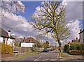
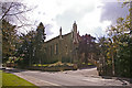
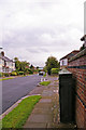
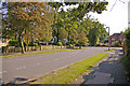
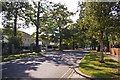
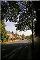
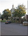
100 photos from this area
Area Information
Key information about the N21 3NB including its size, population, and administrative classification.
- Area Type
- Postcode
- Area Size
- 4565 m²
- Population
- 1770
- Population Density
- 6012 people/km²
House Prices in N21 3NB
31
Properties
£260,182
Average Sold Price
£10,000
Lowest Price
£530,000
Highest Price
Showing 31 properties
| Address | Type | Beds | Baths | Last Sale Price | Last Sale Date | |
|---|---|---|---|---|---|---|
| 49A Station Road, London, N21 3NB | Maisonette | 3 | 1 | £530,000 | Mar 2024 | |
| 47-47-A Station Road, London, N21 3NB | Flat | - | - | £10,000 | Jul 2022 | |
| 55-55-B STATION ROAD, London, N21 3NB | Flat | - | - | £301,000 | Aug 2021 | |
| 47A Station Road, London, N21 3NB | Flat | - | - | £245,000 | Feb 2020 | |
| 57A Station Road, London, N21 3NB | Maisonette | 5 | 4 | £522,500 | Sep 2019 | |
| 45A Station Road, London, N21 3NB | Flat | 3 | 1 | £350,000 | Dec 2012 | |
| 55B Station Road, London, N21 3NB | Flat | - | - | £248,500 | Aug 2012 | |
| 55A Station Road, London, N21 3NB | Flat | - | - | £195,000 | Jun 2008 | |
| 47B Station Road, London, N21 3NB | Flat | - | - | £150,000 | Jan 2004 | |
| 51C Station Road, London, N21 3NB | Flat | 1 | 1 | £120,000 | Jun 2003 |
Page 1 of 4
Energy Efficiency in N21 3NB
Amenities
Schools
| Rank | School | Type | Entry gender | Ages |
|---|
Explore more schools in this area
Go to Schools tabDemographics
Household Size
Family (3-5 people)
most common
Accommodation Type
Flats
most common
Tenure
53
majority
Ethnic Group
White
most common
Religion
N/A
most common
Household Composition
N/A
most common
Age
47
median
Adults (30-64 years)
most common
Household Deprivation
N/A
with no deprivation
NS-SEC
43
in Lower managerial occupations
Explore more demographic insights in this area
Go to Demographics tabPlanning
Planning Constraints
- Flood RiskPremium
- Ramsar Wetland SitesPremium
- Area of Outstanding Natural BeautyPremium
- Protected Nature ReservePremium
- Protected WoodlandPremium