Area Overview for N21 3HU
Photos of N21 3HU
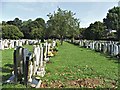
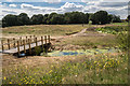

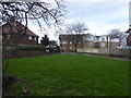
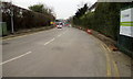
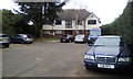
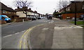
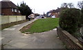
45 photos from this area
Area Information
Key information about the N21 3HU including its size, population, and administrative classification.
- Area Type
- Postcode
- Area Size
- 7860 m²
- Population
- 1899
- Population Density
- 4670 people/km²
House Prices in N21 3HU
18
Properties
£406,040
Average Sold Price
£59,900
Lowest Price
£784,000
Highest Price
Showing 18 properties
| Address | Type | Beds | Baths | Last Sale Price | Last Sale Date | |
|---|---|---|---|---|---|---|
| 13 Laburnum Gardens, Southgate, N21 3HU | Terraced | 3 | 2 | £784,000 | Aug 2024 | |
| 3 Laburnum Gardens, Southgate, N21 3HU | house | - | - | £615,000 | Nov 2020 | |
| 2 Laburnum Gardens, Southgate, N21 3HU | Terraced | 3 | 1 | £530,000 | Feb 2019 | |
| 9 Laburnum Gardens, Southgate, N21 3HU | house | 3 | - | £386,000 | Apr 2011 | |
| 14 Laburnum Gardens, Southgate, N21 3HU | Terraced | - | - | £341,500 | Dec 2006 | |
| 6 Laburnum Gardens, Southgate, N21 3HU | Semi-detached | 4 | - | £388,000 | Dec 2006 | |
| 15 Laburnum Gardens, Southgate, N21 3HU | Terraced | 4 | 2 | £317,000 | Oct 2005 | |
| 11 Laburnum Gardens, Southgate, N21 3HU | Semi-detached | 5 | 3 | £359,000 | Jul 2003 | |
| 7 Laburnum Gardens, Southgate, N21 3HU | Semi-detached | - | - | £280,000 | Jul 2002 | |
| 16 Laburnum Gardens, Southgate, N21 3HU | Terraced | - | - | £59,900 | Sep 1998 |
Page 1 of 2
Energy Efficiency in N21 3HU
Amenities
Schools
| Rank | School | Type | Entry gender | Ages |
|---|
Explore more schools in this area
Go to Schools tabDemographics
Household Size
Family (3-5 people)
most common
Accommodation Type
Houses
most common
Tenure
63
majority
Ethnic Group
White
most common
Religion
N/A
most common
Household Composition
N/A
most common
Age
47
median
Adults (30-64 years)
most common
Household Deprivation
N/A
with no deprivation
NS-SEC
39
in Lower managerial occupations
Explore more demographic insights in this area
Go to Demographics tabPlanning
Planning Constraints
- Flood RiskPremium
- Ramsar Wetland SitesPremium
- Area of Outstanding Natural BeautyPremium
- Protected Nature ReservePremium
- Protected WoodlandPremium