Area Overview for N21 3EP
Photos of N21 3EP
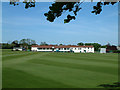
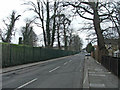
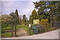
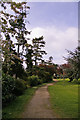
100 photos from this area
Area Information
Key information about the N21 3EP including its size, population, and administrative classification.
- Area Type
- Postcode
- Area Size
- 4473 m²
- Population
- 1852
- Population Density
- 5278 people/km²
House Prices in N21 3EP
15
Properties
£427,272
Average Sold Price
£5,000
Lowest Price
£670,000
Highest Price
Showing 15 properties
| Address | Type | Beds | Baths | Last Sale Price | Last Sale Date | |
|---|---|---|---|---|---|---|
| 95 Ridge Road, Southgate, N21 3EP | Flat | - | - | £5,000 | Feb 2022 | |
| 99 Ridge Road, Southgate, N21 3EP | Semi-detached | 3 | 1 | £670,000 | Oct 2017 | |
| 97 Ridge Road, Southgate, N21 3EP | Semi-detached | 3 | 1 | £660,000 | Jun 2017 | |
| 107 Ridge Road, Southgate, N21 3EP | Semi-detached | 3 | 1 | £530,000 | Feb 2015 | |
| 103 Ridge Road, Southgate, N21 3EP | Semi-detached | 3 | 1 | £516,500 | Jun 2014 | |
| 93 Ridge Road, Southgate, N21 3EP | Semi-detached | 3 | - | £499,950 | Jul 2013 | |
| 105 Ridge Road, Southgate, N21 3EP | Semi-detached | - | - | £393,000 | Apr 2006 | |
| 89 Ridge Road, Southgate, N21 3EP | Semi-detached | - | - | £271,000 | Jul 2001 | |
| 109 Ridge Road, Southgate, N21 3EP | Detached | - | - | £300,000 | Jan 2000 | |
| 95-95-A Ridge Road, Southgate, N21 3EP | Flat | - | - | - | - |
Page 1 of 2
Energy Efficiency in N21 3EP
Amenities
Schools
| Rank | School | Type | Entry gender | Ages |
|---|
Explore more schools in this area
Go to Schools tabDemographics
Household Size
Family (3-5 people)
most common
Accommodation Type
Houses
most common
Tenure
75
majority
Ethnic Group
White
most common
Religion
N/A
most common
Household Composition
N/A
most common
Age
47
median
Adults (30-64 years)
most common
Household Deprivation
N/A
with no deprivation
NS-SEC
41
in Lower managerial occupations
Explore more demographic insights in this area
Go to Demographics tabPlanning
Planning Constraints
- Flood RiskPremium
- Ramsar Wetland SitesPremium
- Area of Outstanding Natural BeautyPremium
- Protected Nature ReservePremium
- Protected WoodlandPremium