Area Overview for N21 2LG
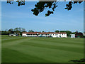
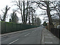
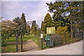
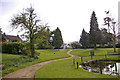
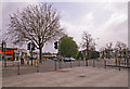
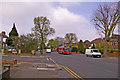
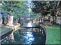
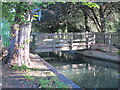
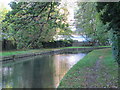
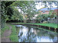
Photos of N21 2LG


Area Information
Living in N21 2LG means being part of a small, tightly knit residential cluster in England, where the population of 1,396 residents creates a quiet, community-focused atmosphere. This area is defined by its modest scale, with homes primarily in the form of houses rather than flats, reflecting a stable, long-term presence of families and individuals. The proximity to Winchmore Hill Station and other rail links offers easy access to nearby towns and cities, while local amenities such as Waitrose Winchmore and Sainsburys Winchmore provide daily essentials. Daily life here balances suburban comfort with practical connectivity, making it suitable for those seeking a low-maintenance lifestyle without sacrificing access to transport and retail. The area’s small size means a strong sense of familiarity among neighbours, though it remains distinct from larger urban centres. For buyers, N21 2LG represents a compact, well-serviced environment where the needs of residents are met within a short radius. The absence of major environmental constraints or high-risk factors further adds to its appeal as a safe, straightforward place to live.
- Area Type
- Postcode
- Area Size
- Not available
- Population
- 1396
- Population Density
- 5242 people/km²
The property market in N21 2LG is dominated by owner-occupied homes, with 88% of properties owned by residents rather than rented. This high rate of home ownership suggests a mature market with limited turnover, where properties are likely to be held for the long term. The accommodation type is primarily houses, which contrasts with areas where flats or apartments predominate. This housing stock indicates a focus on family-friendly, low-density living, with each property offering private space and garden areas. For buyers, this means a market that prioritises stability over investment potential, though the small size of the area may limit options. The proximity to rail links such as Winchmore Hill Station and Grange Park Station also makes it a viable choice for commuters seeking a balance between suburban living and urban accessibility. However, the limited number of properties available means that buyers should act quickly if they identify a suitable home.
House Prices in N21 2LG
No properties found in this postcode.
Energy Efficiency in N21 2LG
Residents of N21 2LG have access to a range of amenities within practical reach, including major retail outlets like Waitrose Winchmore, Tesco Winchmore, and Sainsburys Winchmore, which cater to daily shopping needs. The area’s rail network is particularly well-developed, with stations such as Winchmore Hill, Grange Park, and Bush Hill Park providing direct links to London and nearby suburbs. Metro stations like Southgate and Arnos Grove further expand transport options, while the Whipps Cross Bus Interchange offers local connectivity. This mix of retail and transport options ensures a convenient lifestyle, with minimal need to travel far for essentials. The presence of multiple stations also supports a commuter-friendly environment, allowing residents to balance suburban living with urban opportunities. The area’s amenities contribute to a practical, low-stress daily routine, ideal for those prioritising accessibility and efficiency.
Amenities
Schools
| Rank | School | Type | Entry gender | Ages |
|---|
Explore more schools in this area
Go to Schools tabDemographics
The community in N21 2LG is predominantly composed of adults aged 30–64, with a median age of 47. This suggests a mature, settled population, likely with established careers and family ties. Home ownership is exceptionally high at 88%, indicating a strong preference for long-term residency over rental properties. The accommodation type is primarily houses, which aligns with the area’s character as a residential cluster rather than a high-density development. The predominant ethnic group is White, reflecting a homogenous demographic profile. While no specific data on deprivation is provided, the high home ownership rate and low crime risk suggest a stable socioeconomic environment. This stability may contribute to a quality of life characterised by predictability and low stress, though it also means the community may lack the diversity of larger urban areas. The age profile and ownership figures imply a population that values security and continuity over rapid change.
Household Size
Accommodation Type
Tenure
Ethnic Group
Religion
Household Composition
Age
Household Deprivation
NS-SEC
Explore more demographic insights in this area
Go to Demographics tabPlanning
Planning Constraints
- Flood RiskPremium
- Ramsar Wetland SitesPremium
- Area of Outstanding Natural BeautyPremium
- Protected Nature ReservePremium
- Protected WoodlandPremium