Area Overview for N21 2ET
Photos of N21 2ET
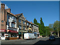


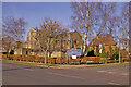
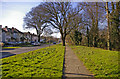


90 photos from this area
Area Information
Key information about the N21 2ET including its size, population, and administrative classification.
- Area Type
- Postcode
- Area Size
- 1.1 hectares
- Population
- 1373
- Population Density
- 2150 people/km²
House Prices in N21 2ET
19
Properties
£662,288
Average Sold Price
£140,000
Lowest Price
£1,330,000
Highest Price
Showing 19 properties
| Address | Type | Beds | Baths | Last Sale Price | Last Sale Date | |
|---|---|---|---|---|---|---|
| 65 Old Park Ridings, Southgate, N21 2ET | Detached | 4 | 1 | £1,105,000 | Jan 2025 | |
| 57 Old Park Ridings, Southgate, N21 2ET | Detached | 4 | 1 | £1,000,000 | Jul 2023 | |
| 67 Old Park Ridings, Southgate, N21 2ET | Detached | 5 | 2 | £1,330,000 | Jan 2023 | |
| 35 Old Park Ridings, Southgate, N21 2ET | house | - | - | £980,000 | Dec 2021 | |
| 41 Old Park Ridings, Southgate, N21 2ET | Terraced | 6 | 1 | £1,050,000 | Mar 2016 | |
| 43 Old Park Ridings, Southgate, N21 2ET | Terraced | 3 | - | £615,000 | Aug 2015 | |
| 43A Old Park Ridings, Southgate, N21 2ET | house | 3 | 1 | £457,500 | May 2011 | |
| 53 Old Park Ridings, Southgate, N21 2ET | Detached | 5 | 3 | £719,995 | Jan 2008 | |
| 55 Old Park Ridings, Southgate, N21 2ET | Detached | - | - | £375,000 | Aug 2001 | |
| 59 Old Park Ridings, Southgate, N21 2ET | Detached | 4 | 2 | £405,000 | Aug 2001 |
Page 1 of 2
Energy Efficiency in N21 2ET
Amenities
Schools
| Rank | School | Type | Entry gender | Ages |
|---|
Explore more schools in this area
Go to Schools tabDemographics
Household Size
Family (3-5 people)
most common
Accommodation Type
Houses
most common
Tenure
85
majority
Ethnic Group
White
most common
Religion
N/A
most common
Household Composition
N/A
most common
Age
47
median
Adults (30-64 years)
most common
Household Deprivation
N/A
with no deprivation
NS-SEC
46
in Lower managerial occupations
Explore more demographic insights in this area
Go to Demographics tabPlanning
Planning Constraints
- Flood RiskPremium
- Ramsar Wetland SitesPremium
- Area of Outstanding Natural BeautyPremium
- Protected Nature ReservePremium
- Protected WoodlandPremium