Area Overview for N21 1TG
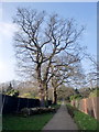
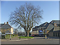
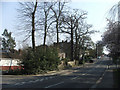
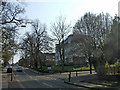
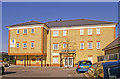
Photos of N21 1TG


Area Information
N21 1TG is a specific postcode area covering a small residential cluster in England. This defined space measures exactly 3061 square metres and holds a population of 1817 people. The population density here is exceptionally high at 593,632 people per square kilometre, reflecting the compact nature of this particular cluster. Living in N21 1TG means residing within a tightly packed environment where residents share immediate proximity to neighbours. The area falls within the Greater London region and serves as a distinct residential node larger than average postal codes but smaller than a standard neighbourhood corridor. You are entering a location defined by its precise geographical boundaries rather than sprawling suburban layouts. Residents here rely on a dense concentration of amenities that cluster very close to their homes. The small size of the area means that daily errands can often be completed without needing to travel far. This postcode sits at the intersection of broader transport routes and local shopping districts. While the square footage is limited, the community access is extensive. Understanding the scale of N21 1TG helps you appreciate the convenience factor of such a concentrated living space. The area functions as a micro-community embedded within the wider London infrastructure network.
- Area Type
- Postcode
- Area Size
- 3061 m²
- Population
- 1817
- Population Density
- 8855 people/km²
The housing stock in N21 1TG is characterised by a preponderance of flats, reflecting the urban density of the postcode. A significant majority of the residential units are flats, which suits the compact 3061 square metre footprint of this specific area. Fifty-seven per cent of residents own their homes, placing this neighbourhood firmly in the realm of owner-occupied territory rather than a high-turnover rental market. This high ownership rate suggests a community where residents have a vested interest in the property values and condition of their homes. Buyers looking at homes in N21 1TG should expect a mix of apartment living that prioritises space efficiency over sprawling grounds. The low population size relative to the housing units indicates that every flat serves a household, reducing the likelihood of large multi-tenant blocks dominating the street scene. If you are considering living in N21 1TG, you are entering a market where property transactions reflect stability and ownership. The prevalence of flats means that energy efficiency and building maintenance are critical factors to consider during your search. Potential buyers will find that the housing profile matches the demographic reality of a mature, owner-led community. This ownership structure often leads to well-maintained exteriors and a stable local investor base.
House Prices in N21 1TG
Showing 1 properties
| Address | Type | Beds | Baths | Last Sale Price | Last Sale Date | |
|---|---|---|---|---|---|---|
| Elizabeth Lodge Nursing Home, 69 Pennington Drive, Southgate, N21 1TG | Retirement | - | - | - | - |
Energy Efficiency in N21 1TG
Residents of N21 1TG enjoy immediate access to a wide array of retail, rail, and metro options within practical reach. Your daily shopping needs are covered by five notable retail outlets, including Sainsburys Highlands, Tesco Southgate Bramley, and M&S Southgate SF. These stores offer essentials and general goods close to your doorstep. For commuters, the transport network is extensive with five metro stations accessible nearby. Significant stops include Oakwood Station, Southgate, and Cockfosters Station, allowing quick connections across the capital. Additionally, five railway stations serve the area, with Grange Park Station, Winchmore Hill Station, and Enfield Chase Station offering direct rail links. You can reach these transport hubs without a long car journey, making N21 1TG a convenient base for working anywhere in London. The proximity of these venues means you can combine walking with public transport effectively. Dining options and leisure facilities cluster around these transport nodes, extending the flavour of the area beyond just the residential street. The density of amenities ensures that a short walk can transform your day from home to work or shop. Living in N21 1TG gives you the flexibility to choose between home ownership and easy access to town centres.
Amenities
Schools
| Rank | School | Type | Entry gender | Ages |
|---|
Explore more schools in this area
Go to Schools tabDemographics
The community in N21 1TG is dominated by adults between the ages of 30 and 64 years. This age group represents the most common demographic bracket for residents in this postcode area. The median age for the population stands at 47 years, indicating a mature resident base rather than a youthful enclave. Home ownership is prevalent, with 57% of households owning their property outright or through a mortgage. The remaining homes are generally within the rental sector or shared ownership schemes. The predominant accommodation type consists of flats, which aligns with the high density requirements of the area. White ethnicity is the predominant group within the local population, contributing to the established character of the neighbourhood. This demographic profile suggests a stable environment where long-term residents have settled down. You will find that most people living in N21 1TG are past the transient phase of early adulthood. The high percentage of owner-occupiers typically translates to greater investment in home improvements and local civic engagement. Family units and couples without children form a significant portion of the adult demographic. Understanding this age split clarifies why local schools might show specific demand patterns and why community events often cater to a broader age range.
Household Size
Accommodation Type
Tenure
Ethnic Group
Religion
Household Composition
Age
Household Deprivation
NS-SEC
Explore more demographic insights in this area
Go to Demographics tabPlanning
Planning Constraints
- Flood RiskPremium
- Ramsar Wetland SitesPremium
- Area of Outstanding Natural BeautyPremium
- Protected Nature ReservePremium
- Protected WoodlandPremium