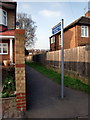
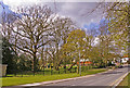
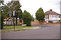
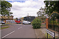
Area Overview for N21 1QN
Photos of N21 1QN
Area Information
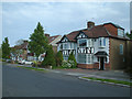
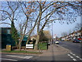
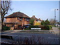
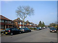
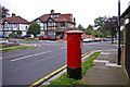
N21 1QN stands as a distinct residential cluster on the outskirts of London, covering an area of just 1.7 hectares. This postcode serves 1,608 individuals within a compact footprint, creating an environment where proximity to one another defines the neighbourhood. A predominance of owner-occupied households shapes the community atmosphere, with 80 per cent of residents holding titles to their properties. The demographic profile centres on adults between 30 and 64 years of age, reflecting a mature population that values stability over rapid turnover. Living in N21 1QN means engaging with a settled community where homes are primarily houses rather than flats. The area benefits from strong digital infrastructure, ensuring that high-speed internet and reliable mobile signals remain standard for daily operations. Residents can access a network of transport hubs that link them to the wider London region. Metro services at Southgate, Oakwood, and Arnos Grove Station sit nearby, alongside rail connections at Winchmore Hill, Grange Park, and Palmers Green. These stations provide practical routes for commuting and leisure travel. The immediate vicinity hosts five retail outlets, including major supermarkets such as M&S Southgate SF, Tesco Chaseside, and Sainsburys Highlands, which serve everyday household needs. This concentration of amenities within practical reach supports a self-sufficient lifestyle without requiring extensive travel. The area remains free from significant planning constraints like protected wetlands or woodlands, allowing for straightforward local development and maintenance. For those seeking a quiet, owner-led residential pocket, this postcode offers a defined and manageable living space.
- Area Type
- Postcode
- Area Size
- 1.7 hectares
- Population
- 1608
- Population Density
- 5658 people/km²
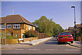
The housing stock in N21 1QN is defined by a heavy leaning towards owner-occupation, with statistics showing 80 per cent of residents own their properties. This figure places the area well above the national average for home ownership, painting a picture of a community established by long-term buyers rather than transient renters. The predominant accommodation type recorded is houses, which suggests the available properties are likely detached or semi-detached units with private outdoor space. This contrasts with areas where flats or maisonettes constitute the majority of the market. For buyers looking at homes in N21 1QN, this means the options present practical living arrangements suited for families or individuals seeking gardens and internal volume. The local market operates with unlike a high-volume rental sector, where the absence of significant rental data points to a stable resident base. The concentration of house ownership implies that the properties hold intrinsic value tied to the community's stability. A potential buyer entering this market should expect to compete with other owner-occupiers rather than competing landlords seeking rental yields. The physical characteristics of the area support this trend, as the designated housing type of houses often commands higher prices due to land scarcity and the desire for private outdoor areas. Within this 1.7 hectare zone, the supply of properties is naturally limited, which can sustain property values over time. The consistency of the housing type means prospective buyers can rely on a uniform standard of layout and size, reducing the risk of unexpected structural issues or unsuitable floor plans.
House Prices in N21 1QN
Showing 56 properties
| Address | Type | Beds | Baths | Last Sale Price | Last Sale Date | |
|---|---|---|---|---|---|---|
| 195 Winchmore Hill Road, Southgate, N21 1QN | house | - | - | £755,000 | Oct 2024 | |
| 181 Winchmore Hill Road, Southgate, N21 1QN | house | - | - | £700,000 | Mar 2021 | |
| 193 Winchmore Hill Road, Southgate, N21 1QN | Semi-detached | 5 | - | £752,000 | Jul 2014 | |
| 177 Winchmore Hill Road, Southgate, N21 1QN | Retail | 5 | 3 | £558,000 | Oct 2013 | |
| 215 Winchmore Hill Road, Southgate, N21 1QN | Detached | 4 | 2 | £700,000 | Mar 2011 | |
| 189 Winchmore Hill Road, Southgate, N21 1QN | Terraced | - | - | £470,000 | Jun 2009 | |
| 191 Winchmore Hill Road, Southgate, N21 1QN | Terraced | - | - | £462,000 | Aug 2007 | |
| 199 Winchmore Hill Road, Southgate, N21 1QN | Detached | 4 | 3 | £398,950 | Jan 2005 | |
| 179 Winchmore Hill Road, Southgate, N21 1QN | Semi-detached | 1 | 1 | £420,000 | Apr 2004 | |
| 209 Winchmore Hill Road, Southgate, N21 1QN | Detached | - | - | £490,000 | Feb 2004 |
Energy Efficiency in N21 1QN
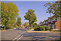
Daily life for residents of N21 1QN revolves around a network of amenities located within practical reach. Five retail outlets serve the local community, providing essential goods without the need to travel further afield. Major stores such as M&S Southgate SF, Tesco Chaseside, and Sainsburys Highlands anchor this retail provision, allowing residents to purchase groceries and household items conveniently. These supermarkets are large enough to meet weekly shopping needs, stock varied produce, and offer ready-made meals for busy households. The presence of these specific named venues confirms that no specialised arrangement is required to sustain a full domestic life. Transport connectivity further enhances lifestyle convenience through five accessible metro and rail stations nearby. Southgate and Arnos Grove stations offer Underground services, while Winchmore Hill, Grange Park, and Palmers Green provide rail links. This diversity ensures that reaching central London or other suburbs takes less time than in areas with limited station coverage. The combination of retail depth and travel speed creates an efficient routine where residents work, shop, and commute from a single postcode. Living in N21 1QN means having necessary services immediately available, reducing time spent in transit or detouring to larger shopping districts. The area focuses on functional comfort rather than luxury, prioritising the practicalities of daily life over entertainment spots or high-end dining. For those valuing time efficiency and reliable access to goods, this configuration of amenities works in their favour.
Amenities
Schools
| Rank | School | Type | Entry gender | Ages |
|---|
Explore more schools in this area
Go to Schools tabDemographics
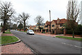
The community in N21 1QN reflects a stable demographic profile with a median age of 47 years. Adults in the 30 to 64 year age range constitute the most common group, suggesting the area caters to families and established professionals. This age distribution indicates a heavy reliance on paid work, with residents likely active in the local and wider London job markets. Home ownership is widespread, with 80 per cent of residents owning their homes outright or with a mortgage. This high level of tenure relates to a predominantly housing market built on detached or semi-detached houses rather than rental flats or shared accommodation. The predominant ethnic group is White, which aligns with the historical settlement patterns of North London suburbs. The visual character of the neighbourhood consists almost entirely of houses, creating a uniform streetscape typical of council estate developments or post-war housing schemes. This accommodation type supports private gardens and internal space, appealing to those who prefer domestic privacy. The population density stands at 93,257 people per square kilometre, indicating a densely packed urban environment despite the small 1.7 hectare size. Such density means residents are closer to neighbours and public services than those in sprawling rural villages. While the area is primarily composed of households headed by working adults, the presence of children in the wider catchment areas may bring school-aged populations nearby. The community feels entrenched, with long-term residents forming the core social fabric. There is little evidence of transient populations, as suggested by the high home ownership rate and consistent age bracket. This stability creates a predictable environment where local routines and neighbourly interactions remain consistent over time.
Household Size
Accommodation Type
Tenure
Ethnic Group
Religion
Household Composition
Age
Household Deprivation
NS-SEC
Explore more demographic insights in this area
Go to Demographics tabPlanning
Planning Constraints
- Flood RiskPremium
- Ramsar Wetland SitesPremium
- Area of Outstanding Natural BeautyPremium
- Protected Nature ReservePremium
- Protected WoodlandPremium