Area Overview for N21 1DE
Photos of N21 1DE


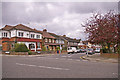
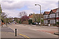

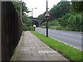

90 photos from this area
Area Information
Key information about the N21 1DE including its size, population, and administrative classification.
- Area Type
- Postcode
- Area Size
- 1.4 hectares
- Population
- 1660
- Population Density
- 3231 people/km²
House Prices in N21 1DE
27
Properties
£703,965
Average Sold Price
£148,000
Lowest Price
£1,225,000
Highest Price
Showing 27 properties
| Address | Type | Beds | Baths | Last Sale Price | Last Sale Date | |
|---|---|---|---|---|---|---|
| 66 Cheyne Walk, Southgate, N21 1DE | Semi-detached | 3 | - | £950,000 | Feb 2023 | |
| 52 Cheyne Walk, Southgate, N21 1DE | house | - | - | £1,225,000 | Nov 2021 | |
| 76 Cheyne Walk, Southgate, N21 1DE | Semi-detached | 4 | 1 | £915,000 | Sep 2021 | |
| 64 Cheyne Walk, Southgate, N21 1DE | Semi-detached | 4 | 1 | £840,000 | Sep 2020 | |
| 54 Cheyne Walk, Southgate, N21 1DE | Semi-detached | 4 | 2 | £979,000 | Jan 2018 | |
| 86 Cheyne Walk, Southgate, N21 1DE | house | - | - | £860,000 | Nov 2016 | |
| 44 Cheyne Walk, Southgate, N21 1DE | Semi-detached | 5 | - | £935,000 | Nov 2016 | |
| 38 Cheyne Walk, Southgate, N21 1DE | Semi-detached | 6 | 2 | £1,087,500 | Apr 2016 | |
| 90 Cheyne Walk, Southgate, N21 1DE | Semi-detached | 4 | 1 | £825,000 | Sep 2015 | |
| 46 Cheyne Walk, Southgate, N21 1DE | Semi-detached | 4 | - | £760,000 | Sep 2014 |
Page 1 of 3
Energy Efficiency in N21 1DE
Amenities
Schools
| Rank | School | Type | Entry gender | Ages |
|---|
Explore more schools in this area
Go to Schools tabDemographics
Household Size
Family (3-5 people)
most common
Accommodation Type
Houses
most common
Tenure
82
majority
Ethnic Group
White
most common
Religion
N/A
most common
Household Composition
N/A
most common
Age
47
median
Adults (30-64 years)
most common
Household Deprivation
N/A
with no deprivation
NS-SEC
49
in Lower managerial occupations
Explore more demographic insights in this area
Go to Demographics tabPlanning
Planning Constraints
- Flood RiskPremium
- Ramsar Wetland SitesPremium
- Area of Outstanding Natural BeautyPremium
- Protected Nature ReservePremium
- Protected WoodlandPremium