Area Overview for N21 1AB
Photos of N21 1AB
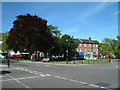
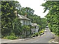
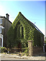
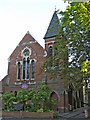
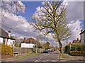

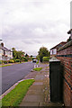
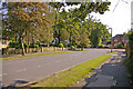
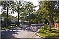
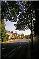
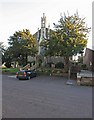
100 photos from this area
Area Information
Key information about the N21 1AB including its size, population, and administrative classification.
- Area Type
- Postcode
- Area Size
- 7054 m²
- Population
- 1541
- Population Density
- 4971 people/km²
House Prices in N21 1AB
14
Properties
£713,118
Average Sold Price
£194,300
Lowest Price
£1,250,000
Highest Price
Showing 14 properties
| Address | Type | Beds | Baths | Last Sale Price | Last Sale Date | |
|---|---|---|---|---|---|---|
| 9 Broadfields Avenue, Southgate, N21 1AB | house | 4 | 2 | £1,250,000 | Jun 2022 | |
| 7 Broadfields Avenue, Southgate, N21 1AB | Semi-detached | 5 | 2 | £1,115,000 | Apr 2022 | |
| 17 Broadfields Avenue, Southgate, N21 1AB | Semi-detached | 5 | 3 | £1,080,000 | Oct 2020 | |
| 27 Broadfields Avenue, Southgate, N21 1AB | Semi-detached | 3 | 1 | £920,000 | Dec 2019 | |
| 25 Broadfields Avenue, Southgate, N21 1AB | house | - | - | £775,000 | Jul 2015 | |
| 11 Broadfields Avenue, Southgate, N21 1AB | house | - | - | £615,000 | Jun 2012 | |
| 21 Broadfields Avenue, Southgate, N21 1AB | Semi-detached | - | - | £535,000 | Jul 2006 | |
| 5 Broadfields Avenue, Southgate, N21 1AB | Semi-detached | - | - | £495,000 | Jan 2006 | |
| 19 Broadfields Avenue, Southgate, N21 1AB | Semi-detached | - | - | £495,000 | Oct 2005 | |
| 23 Broadfields Avenue, Southgate, N21 1AB | Semi-detached | 3 | 1 | £370,000 | May 2002 |
Page 1 of 2
Energy Efficiency in N21 1AB
Amenities
Schools
| Rank | School | Type | Entry gender | Ages |
|---|
Explore more schools in this area
Go to Schools tabDemographics
Household Size
Family (3-5 people)
most common
Accommodation Type
Houses
most common
Tenure
84
majority
Ethnic Group
White
most common
Religion
N/A
most common
Household Composition
N/A
most common
Age
47
median
Adults (30-64 years)
most common
Household Deprivation
N/A
with no deprivation
NS-SEC
52
in Lower managerial occupations
Explore more demographic insights in this area
Go to Demographics tabPlanning
Planning Constraints
- Flood RiskPremium
- Ramsar Wetland SitesPremium
- Area of Outstanding Natural BeautyPremium
- Protected Nature ReservePremium
- Protected WoodlandPremium