Area Overview for N20 9JS
Photos of N20 9JS
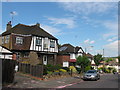
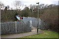
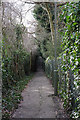
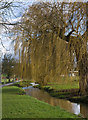


83 photos from this area
Area Information
Key information about the N20 9JS including its size, population, and administrative classification.
- Area Type
- Postcode
- Area Size
- 2.3 hectares
- Population
- 1426
- Population Density
- 3037 people/km²
House Prices in N20 9JS
16
Properties
£1,679,000
Average Sold Price
£730,000
Lowest Price
£2,850,000
Highest Price
Showing 16 properties
| Address | Type | Beds | Baths | Last Sale Price | Last Sale Date | |
|---|---|---|---|---|---|---|
| 3 Oakleigh Park South, Whetstone, London, N20 9JS | Detached | 6 | 3 | £2,350,000 | Dec 2025 | |
| 5 Oakleigh Park South, Whetstone, London, N20 9JS | house | 4 | 3 | £2,370,000 | Feb 2022 | |
| 9 Oakleigh Park South, Whetstone, London, N20 9JS | Semi-detached | 4 | 2 | £1,525,000 | Jun 2021 | |
| 29 Oakleigh Park South, Whetstone, London, N20 9JS | Detached | 4 | 1 | £1,700,000 | Jul 2019 | |
| Throstle House, 19 Oakleigh Park South, Whetstone, London, N20 9JS | Detached | 6 | 2 | £1,665,000 | Mar 2019 | |
| 25 Oakleigh Park South, Whetstone, London, N20 9JS | Retail | 1 | 1 | £2,850,000 | Oct 2017 | |
| 27 Oakleigh Park South, Whetstone, London, N20 9JS | house | 5 | - | £1,200,000 | Feb 2013 | |
| 1 Oakleigh Park South, Whetstone, London, N20 9JS | Detached | - | - | £1,650,000 | May 2008 | |
| 7 Oakleigh Park South, Whetstone, London, N20 9JS | house | 6 | - | £730,000 | Jul 2004 | |
| 23 Oakleigh Park South, Whetstone, London, N20 9JS | Detached | - | - | £750,000 | Oct 2002 |
Page 1 of 2
Energy Efficiency in N20 9JS
Amenities
Schools
| Rank | School | Type | Entry gender | Ages |
|---|
Explore more schools in this area
Go to Schools tabDemographics
Household Size
Family (3-5 people)
most common
Accommodation Type
Houses
most common
Tenure
85
majority
Ethnic Group
White
most common
Religion
N/A
most common
Household Composition
N/A
most common
Age
47
median
Adults (30-64 years)
most common
Household Deprivation
N/A
with no deprivation
NS-SEC
52
in Lower managerial occupations
Explore more demographic insights in this area
Go to Demographics tabPlanning
Planning Constraints
- Flood RiskPremium
- Ramsar Wetland SitesPremium
- Area of Outstanding Natural BeautyPremium
- Protected Nature ReservePremium
- Protected WoodlandPremium