Area Overview for N20 8PL
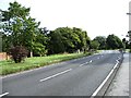
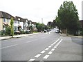
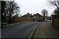
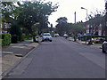
Photos of N20 8PL


Area Information
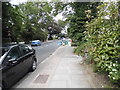
Living in N20 8PL means being part of a tightly knit residential cluster in north London, where 1,365 residents occupy a compact area with a population density of 271 people per square kilometre. This postcode is characterised by a mature community, with a median age of 47 and a strong presence of adults aged 30–64. The area is predominantly owner-occupied, with 86% of homes owned by residents, and most properties are houses rather than flats. Daily life here is shaped by proximity to essential services, including schools, retail, and transport hubs. The low crime risk score of 82 and no flood risk make it a secure place to live, while the lack of environmental constraints such as protected woodlands or AONB status suggests a practical, unencumbered living environment. N20 8PL is ideal for those seeking a stable, family-oriented community with access to nearby amenities and a manageable commute.
- Area Type
- Postcode
- Area Size
- Not available
- Population
- 1365
- Population Density
- 271 people/km²
The property market in N20 8PL is dominated by owner-occupied homes, with 86% of properties owned by residents rather than rented. This suggests a stable market with limited rental activity, which is typical of areas with a mature demographic. The accommodation type is primarily houses, which are more common than flats in this postcode. This housing stock caters to families and professionals seeking private, spacious living. Given the small size of the area, the market is likely limited in scope, with buyers needing to consider nearby postcodes for additional options. The high home ownership rate indicates a low turnover of properties, which may mean fewer new listings but also less competition for existing homes. For buyers, this could translate to a predictable market with established property values.
House Prices in N20 8PL
No properties found in this postcode.
Energy Efficiency in N20 8PL
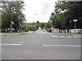
Residents of N20 8PL enjoy a lifestyle enhanced by nearby amenities. The area’s proximity to five metro stations, including Woodside Park and West Finchley, ensures easy access to public transport. Retail hubs like Waitrose Whetstone and Sainsburys North provide convenient shopping options, while M&S Whetstone SF adds variety. Rail stations such as New Barnet and New Southgate offer connections to further destinations. Though the data does not mention parks or leisure facilities, the presence of multiple retail and transport points suggests a focus on practicality and convenience. The area’s character is defined by its accessibility and the availability of essential services, making daily life efficient for residents.
Amenities
Schools
Residents of N20 8PL have access to a range of educational institutions. St Andrew’s CofE Voluntary Aided Primary School in Totteridge is a primary school with a good Ofsted rating, offering a solid foundation for younger children. The Ravenscroft School, also a primary school, is nearby but lacks an Ofsted rating in the data. The Totteridge Academy, an academy school, is listed twice in the data, both with a good Ofsted rating. This mix of primary and academy schools provides families with choices, from early education to secondary schooling. The presence of two schools with good ratings suggests a commitment to quality education in the area. However, the lack of specific details on school capacity or catchment areas means prospective families should verify admissions processes directly.
| Rank | School | Type | Entry gender | Ages |
|---|
Explore more schools in this area
Go to Schools tabDemographics
The community in N20 8PL is defined by its age profile, with a median age of 47 and the majority of residents falling within the 30–64 age range. This suggests a population of largely established professionals and families. Home ownership is high, at 86%, indicating a stable, long-term resident base. The accommodation type is predominantly houses, reflecting a suburban character rather than high-density living. The predominant ethnic group is White, though no specific diversity statistics are provided. The absence of data on deprivation or socioeconomic breakdown means that while the area appears to have a cohesive demographic, its broader social dynamics remain less detailed. The age range and ownership figures imply a community focused on long-term residency and family life, with fewer transient populations.
Household Size
Accommodation Type
Tenure
Ethnic Group
Religion
Household Composition
Age
Household Deprivation
NS-SEC
Explore more demographic insights in this area
Go to Demographics tabPlanning
Planning Constraints
- Flood RiskPremium
- Ramsar Wetland SitesPremium
- Area of Outstanding Natural BeautyPremium
- Protected Nature ReservePremium
- Protected WoodlandPremium