Area Overview for N20 8NE
Photos of N20 8NE
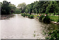

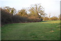
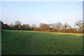
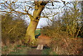

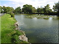
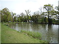
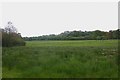
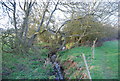


38 photos from this area
Area Information
Key information about the N20 8NE including its size, population, and administrative classification.
- Area Type
- Postcode
- Area Size
- 30.6 hectares
- Population
- 1365
- Population Density
- 271 people/km²
House Prices in N20 8NE
17
Properties
£2,500,000
Average Sold Price
£950,000
Lowest Price
£4,300,000
Highest Price
Showing 17 properties
| Address | Type | Beds | Baths | Last Sale Price | Last Sale Date | |
|---|---|---|---|---|---|---|
| The Spinney, 28 Totteridge Common, Whetstone, London, N20 8NE | house | 5 | - | £4,300,000 | Jun 2013 | |
| 30 Totteridge Common, Whetstone, London, N20 8NE | Detached | 5 | 5 | £2,250,000 | Nov 2006 | |
| West Lodge, 36 Totteridge Common, Whetstone, London, N20 8NE | Detached | - | - | £950,000 | Jul 1997 | |
| Totteridge Park Farm, 32 Totteridge Common, Whetstone, London, N20 8NE | Semi-detached | 5 | 5 | - | - | |
| Willow House, 38 Totteridge Common, Whetstone, London, N20 8NE | Detached | 4 | 2 | - | - | |
| The Bungalow, Totteridge Park Farm, 32 Totteridge Common, Whetstone, London, N20 8NE | Detached | - | - | - | - | |
| The Paddocks, 24 Totteridge Common, Whetstone, London, N20 8NE | Detached | 6 | 5 | - | - | |
| The Paddocks, Totteridge Common, Whetstone, London, N20 8NE | Detached | 5 | 5 | - | - | |
| Tennis 33M From 24A, Totteridge Common 57M From Unnamed Road, Footpath From Totteridge Common Via Horseshoe Lane To Mays Lane, Whetstone, London, N20 8NE | Leisure | - | - | - | - | |
| Cottage, West Lodge, 36 Totteridge Common, Whetstone, London, N20 8NE | Detached | - | - | - | - |
Page 1 of 2
Energy Efficiency in N20 8NE
Amenities
Schools
| Rank | School | Type | Entry gender | Ages |
|---|
Explore more schools in this area
Go to Schools tabDemographics
Household Size
Family (3-5 people)
most common
Accommodation Type
Houses
most common
Tenure
86
majority
Ethnic Group
White
most common
Religion
N/A
most common
Household Composition
N/A
most common
Age
47
median
Adults (30-64 years)
most common
Household Deprivation
N/A
with no deprivation
NS-SEC
50
in Lower managerial occupations
Explore more demographic insights in this area
Go to Demographics tabPlanning
Planning Constraints
- Flood RiskPremium
- Ramsar Wetland SitesPremium
- Area of Outstanding Natural BeautyPremium
- Protected Nature ReservePremium
- Protected WoodlandPremium