Area Overview for N20 2DB
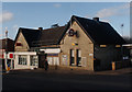
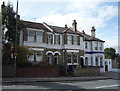
Photos of N20 2DB


Area Information
Living in N20 2DB means being part of a small, tightly knit residential cluster in England, home to 1,789 residents. This postcode area is characterised by its compact size and a population skewed towards adults aged 30–64, with a median age of 47. The community feels established, with a strong presence of owner-occupied flats, reflecting a mature demographic. Daily life here is shaped by proximity to local amenities, schools, and transport links. While the area is not vast, its density offers convenience without sacrificing the quietude typical of suburban living. The mix of retail, transport, and educational facilities within walking distance makes it appealing for families and professionals seeking balance between urban accessibility and residential comfort. N20 2DB is not a sprawling suburb but a focused cluster where neighbours are likely to know each other, and community ties are evident. Its compact nature means it’s ideal for those prioritising proximity to essential services over expansive green spaces, though nearby parks and stations provide respite and connectivity.
- Area Type
- Postcode
- Area Size
- Not available
- Population
- 1789
- Population Density
- 6646 people/km²
The property market in N20 2DB is defined by its high home ownership rate of 69%, indicating that most properties are owner-occupied rather than rented. The accommodation type is predominantly flats, which suggests a housing stock suited to smaller households or couples. This is typical of areas with limited land availability, where multi-unit buildings are the norm. Given the small size of the postcode area, the housing stock is likely to be constrained, with limited new developments. For buyers, this means competition for available properties, particularly in the flat market. The presence of flats may also mean that properties are more likely to be part of larger residential complexes, which could influence both pricing and maintenance responsibilities. While the data does not specify rental availability, the high home ownership rate suggests that the area is less reliant on the rental market than other parts of the country. Buyers should consider the compact nature of the area and its focus on flats when evaluating long-term suitability.
House Prices in N20 2DB
No properties found in this postcode.
Energy Efficiency in N20 2DB
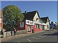
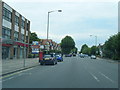
The lifestyle in N20 2DB is shaped by its proximity to a range of amenities, from retail to transport. Within walking distance are notable venues such as Waitrose Whetstone, M&S Whetstone SF, and Tesco Whetstone, offering a mix of high-end and everyday shopping. These retail options provide convenience for grocery and lifestyle needs, reducing the need for longer trips. The area’s transport links, including multiple metro and rail stations, enhance accessibility to leisure, dining, and cultural activities beyond the immediate postcode. While the data does not specify parks or recreational facilities, the absence of environmental constraints like protected woodlands or AONB areas suggests open spaces may be available nearby. The combination of retail, transport, and moderate connectivity creates a lifestyle that balances convenience with the ability to explore further afield. For residents, daily life is likely to revolve around local shops, regular commutes, and the practicality of nearby stations, making it suitable for those prioritising accessibility over expansive natural amenities.
Amenities
Schools
Residents of N20 2DB have access to three primary schools within practical reach: Queenswell Infant & Nursery School, Queenswell Junior School, and Alma Primary. All three hold a ‘good’ Ofsted rating, indicating a reliable standard of education for younger children. The presence of two primary schools serving the same area suggests a focus on early education, with no secondary schools listed in the data. This means families with children requiring secondary education may need to look beyond N20 2DB for options. The concentration of primary schools is beneficial for families with young children, offering proximity to schooling and potentially reducing commute times. However, the absence of secondary schools in the immediate vicinity could be a consideration for those planning for long-term educational needs. The ‘good’ ratings suggest that local schools are performing adequately, though parents may still seek additional resources or private schooling for older children.
| Rank | School | Type | Entry gender | Ages |
|---|
Explore more schools in this area
Go to Schools tabDemographics
The community in N20 2DB is predominantly composed of adults aged 30–64, with a median age of 47. This suggests a mature, stable population, likely with established careers and families. Home ownership is high at 69%, indicating a strong presence of long-term residents rather than transient renters. The accommodation type is predominantly flats, which aligns with the area’s compact layout and density. The predominant ethnic group is White, reflecting a homogenous demographic profile. While no data on deprivation is provided, the high home ownership and age profile suggest a relatively stable economic environment. The absence of specific diversity metrics means the community’s cultural composition remains unquantified, but the data implies a cohesive, settled population. For buyers, this demographic stability may translate to consistent property values and a low turnover of residents. The focus on flats also means the housing stock is likely to be older, with potential implications for maintenance costs and space.
Household Size
Accommodation Type
Tenure
Ethnic Group
Religion
Household Composition
Age
Household Deprivation
NS-SEC
Explore more demographic insights in this area
Go to Demographics tabPlanning
Planning Constraints
- Flood RiskPremium
- Ramsar Wetland SitesPremium
- Area of Outstanding Natural BeautyPremium
- Protected Nature ReservePremium
- Protected WoodlandPremium