Area Overview for N20 0QQ
Photos of N20 0QQ
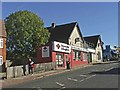
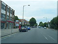
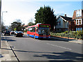
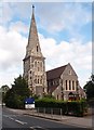
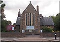
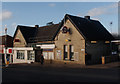
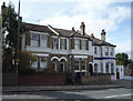
86 photos from this area
Area Information
Key information about the N20 0QQ including its size, population, and administrative classification.
- Area Type
- Postcode
- Area Size
- 6825 m²
- Population
- 1961
- Population Density
- 11199 people/km²
House Prices in N20 0QQ
18
Properties
£412,950
Average Sold Price
£115,000
Lowest Price
£665,000
Highest Price
Showing 18 properties
| Address | Type | Beds | Baths | Last Sale Price | Last Sale Date | |
|---|---|---|---|---|---|---|
| 20 Derwent Crescent, Whetstone, London, N20 0QQ | Semi-detached | 4 | 1 | £665,000 | Mar 2025 | |
| 18 Derwent Crescent, Whetstone, London, N20 0QQ | Semi-detached | - | - | £500,000 | Apr 2023 | |
| 24 Derwent Crescent, Whetstone, London, N20 0QQ | Semi-detached | 4 | 3 | £653,500 | Aug 2019 | |
| 2 Derwent Crescent, Whetstone, London, N20 0QQ | house | 5 | 1 | £510,000 | Mar 2013 | |
| 30 Derwent Crescent, Whetstone, London, N20 0QQ | Semi-detached | 4 | - | £499,999 | Feb 2013 | |
| 8 Derwent Crescent, Whetstone, London, N20 0QQ | house | 5 | - | £470,000 | Nov 2011 | |
| 10 Derwent Crescent, Whetstone, London, N20 0QQ | Terraced | 5 | 3 | £293,000 | Mar 2002 | |
| 14 Derwent Crescent, Whetstone, London, N20 0QQ | Semi-detached | - | - | £250,000 | Jan 2002 | |
| 22 Derwent Crescent, Whetstone, London, N20 0QQ | Semi-detached | 4 | 1 | £173,000 | Nov 1998 | |
| 2B Derwent Crescent, Whetstone, London, N20 0QQ | Semi-detached | 4 | - | £115,000 | Jan 1995 |
Page 1 of 2
Energy Efficiency in N20 0QQ
Amenities
Schools
| Rank | School | Type | Entry gender | Ages |
|---|
Explore more schools in this area
Go to Schools tabDemographics
Household Size
Family (3-5 people)
most common
Accommodation Type
Flats
most common
Tenure
43
majority
Ethnic Group
White
most common
Religion
N/A
most common
Household Composition
N/A
most common
Age
47
median
Adults (30-64 years)
most common
Household Deprivation
N/A
with no deprivation
NS-SEC
43
in Lower managerial occupations
Explore more demographic insights in this area
Go to Demographics tabPlanning
Planning Constraints
- Flood RiskPremium
- Ramsar Wetland SitesPremium
- Area of Outstanding Natural BeautyPremium
- Protected Nature ReservePremium
- Protected WoodlandPremium