Area Overview for N20 0PD
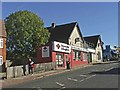
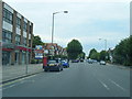
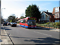
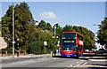
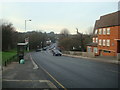
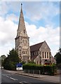
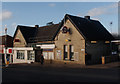
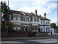
Photos of N20 0PD


Area Information
Living in N20 0PD means inhabiting a small, tightly knit residential cluster in north London, where the population of 1,789 reflects a community shaped by stability and proximity to key amenities. The area’s compact size ensures a quiet, localised feel, with homes primarily in flats, catering to a demographic of adults aged 30–64. Residents benefit from nearby primary schools, including Queenswell Infant & Nursery School and Alma Primary, both rated ‘good’ by Ofsted, ensuring educational options for families. Transport links are robust, with multiple metro and rail stations within reach, including Totteridge & Whetstone and New Barnet, facilitating easy access to central London. Digital connectivity is strong, with broadband and mobile scores above 75, supporting both daily use and remote work. While the area lacks natural constraints like protected woodlands or AONB designations, its safety profile is mixed: flood risk is low, but crime risk is medium, requiring standard precautions. N20 0PD offers a practical, accessible lifestyle for those prioritising convenience and connectivity over sprawling landscapes.
- Area Type
- Postcode
- Area Size
- Not available
- Population
- 1789
- Population Density
- 6646 people/km²
The property market in N20 0PD is defined by its compact size and reliance on flats, with 69% of homes owner-occupied. This suggests a balance between private ownership and rental availability, though the absence of terraced or detached homes limits diversity in housing stock. The area’s small footprint means buyers must consider proximity to amenities and transport when evaluating properties. Flats here are likely to be in multi-unit buildings, possibly with shared communal spaces. Given the median age of residents and the prevalence of adults in the 30–64 range, the market may appeal to professionals or retirees seeking low-maintenance living. However, the limited size of N20 0PD means property choices are constrained, and buyers should prioritise locations near schools, stations, and retail hubs like Waitrose Whetstone to maximise convenience.
House Prices in N20 0PD
No properties found in this postcode.
Energy Efficiency in N20 0PD
The lifestyle in N20 0PD is shaped by its proximity to retail, dining, and transport hubs. Within walking distance are major retailers like Waitrose Whetstone, M&S Whetstone, and Tesco Whetstone, offering a range of shopping options. The area’s transport links, including Totteridge & Whetstone Station and nearby rail services, provide easy access to London’s cultural and commercial centres. While no specific parks or leisure venues are listed, the presence of a ferry service and multiple stations suggests opportunities for recreation beyond the immediate area. The compact nature of N20 0PD means daily life revolves around local amenities, with a focus on practicality. Residents benefit from a mix of retail and transport options that support both routine needs and occasional excursions, though the area’s small size may require venturing further for more specialised services.
Amenities
Schools
Residents of N20 0PD have access to three primary schools within practical reach: Queenswell Infant & Nursery School, Queenswell Junior School, and Alma Primary. All three are rated ‘good’ by Ofsted, providing a reliable foundation for early education. The presence of two primary schools serving the same area suggests a focus on younger children, though no secondary schools are listed in the data. For families, this means proximity to quality primary education, which can be a key factor in choosing a home. However, those requiring secondary schooling may need to look beyond N20 0PD, as no secondary schools are mentioned. The consistent ‘good’ ratings indicate a standard of teaching and facilities that meet regulatory benchmarks, though specific curricular strengths are not detailed.
| Rank | School | Type | Entry gender | Ages |
|---|
Explore more schools in this area
Go to Schools tabDemographics
N20 0PD’s population of 1,789 is predominantly composed of adults aged 30–64, with a median age of 47. This suggests a mature, established community, likely with long-term residents and fewer young families. Home ownership stands at 69%, indicating a mix of owner-occupied and rental properties, though the accommodation type is exclusively flats. This implies a higher proportion of rental units, possibly attracting professionals or those seeking manageable housing in a compact area. The predominant ethnic group is White, with no data provided on other demographics. The age profile and home ownership rate suggest a stable, middle-aged population with fewer transient residents. While deprivation data is not specified, the presence of good schools and transport links may support a quality of life that balances practicality with accessibility for this demographic.
Household Size
Accommodation Type
Tenure
Ethnic Group
Religion
Household Composition
Age
Household Deprivation
NS-SEC
Explore more demographic insights in this area
Go to Demographics tabPlanning
Planning Constraints
- Flood RiskPremium
- Ramsar Wetland SitesPremium
- Area of Outstanding Natural BeautyPremium
- Protected Nature ReservePremium
- Protected WoodlandPremium