Area Overview for N20 0AS
Photos of N20 0AS
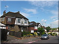
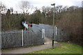


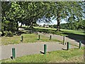


83 photos from this area
Area Information
Key information about the N20 0AS including its size, population, and administrative classification.
- Area Type
- Postcode
- Area Size
- 5973 m²
- Population
- 2049
- Population Density
- 7187 people/km²
House Prices in N20 0AS
19
Properties
£347,995
Average Sold Price
£121,000
Lowest Price
£625,000
Highest Price
Showing 19 properties
| Address | Type | Beds | Baths | Last Sale Price | Last Sale Date | |
|---|---|---|---|---|---|---|
| 118 Russell Lane, Whetstone, London, N20 0AS | Semi-detached | 3 | 1 | £600,000 | Jun 2024 | |
| 104A Russell Lane, Whetstone, London, N20 0AS | Maisonette | 2 | 1 | £375,000 | Jan 2024 | |
| 116 Russell Lane, Whetstone, London, N20 0AS | house | - | - | £625,000 | Jul 2022 | |
| 106A Russell Lane, Whetstone, London, N20 0AS | Maisonette | - | - | £395,000 | Dec 2020 | |
| 120 Russell Lane, Whetstone, London, N20 0AS | Semi-detached | 3 | 1 | £440,000 | Mar 2013 | |
| 108 Russell Lane, Whetstone, London, N20 0AS | house | 3 | - | £355,000 | Sep 2010 | |
| 102A Russell Lane, Whetstone, London, N20 0AS | Flat | 2 | 1 | £227,000 | Mar 2008 | |
| 100A Russell Lane, Whetstone, London, N20 0AS | Flat | 2 | 1 | £159,950 | Sep 2002 | |
| 104B Russell Lane, Whetstone, London, N20 0AS | Maisonette | 2 | 1 | £121,000 | Jul 2000 | |
| 114 Russell Lane, Whetstone, London, N20 0AS | Semi-detached | 3 | 2 | £182,000 | Jul 1999 |
Page 1 of 2
Energy Efficiency in N20 0AS
Amenities
Schools
| Rank | School | Type | Entry gender | Ages |
|---|
Explore more schools in this area
Go to Schools tabDemographics
Household Size
Family (3-5 people)
most common
Accommodation Type
Houses
most common
Tenure
81
majority
Ethnic Group
White
most common
Religion
N/A
most common
Household Composition
N/A
most common
Age
47
median
Adults (30-64 years)
most common
Household Deprivation
N/A
with no deprivation
NS-SEC
39
in Lower managerial occupations
Explore more demographic insights in this area
Go to Demographics tabPlanning
Planning Constraints
- Flood RiskPremium
- Ramsar Wetland SitesPremium
- Area of Outstanding Natural BeautyPremium
- Protected Nature ReservePremium
- Protected WoodlandPremium