Area Overview for N2 9QN
Photos of N2 9QN


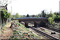

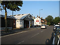
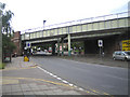
100 photos from this area
Area Information
Key information about the N2 9QN including its size, population, and administrative classification.
- Area Type
- Postcode
- Area Size
- 1.0 hectares
- Population
- 1619
- Population Density
- 7386 people/km²
House Prices in N2 9QN
34
Properties
£978,935
Average Sold Price
£102,000
Lowest Price
£1,650,000
Highest Price
Showing 34 properties
| Address | Type | Beds | Baths | Last Sale Price | Last Sale Date | |
|---|---|---|---|---|---|---|
| 29 Summerlee Gardens, East Finchley, London, N2 9QN | Terraced | 4 | 2 | £1,600,000 | Sep 2023 | |
| 28 Summerlee Gardens, East Finchley, London, N2 9QN | Terraced | 3 | 1 | £1,400,000 | Jun 2023 | |
| 30 Summerlee Gardens, East Finchley, London, N2 9QN | Terraced | 4 | 2 | £1,485,000 | Sep 2022 | |
| 32 Summerlee Gardens, East Finchley, London, N2 9QN | house | - | - | £1,650,000 | Aug 2022 | |
| 14 Summerlee Gardens, East Finchley, London, N2 9QN | Terraced | - | - | £960,000 | Jul 2022 | |
| 13 Summerlee Gardens, East Finchley, London, N2 9QN | Terraced | 5 | 2 | £1,280,000 | Apr 2022 | |
| 23 Summerlee Gardens, East Finchley, London, N2 9QN | house | - | - | £1,230,000 | Mar 2021 | |
| 33 Summerlee Gardens, East Finchley, London, N2 9QN | house | - | - | £1,345,000 | Jan 2021 | |
| 16 Summerlee Gardens, East Finchley, London, N2 9QN | Terraced | 3 | - | £1,200,000 | Jul 2020 | |
| 1 Summerlee Gardens, East Finchley, London, N2 9QN | Terraced | 4 | 1 | £1,070,000 | Sep 2019 |
Page 1 of 4
Energy Efficiency in N2 9QN
Amenities
Schools
| Rank | School | Type | Entry gender | Ages |
|---|
Explore more schools in this area
Go to Schools tabDemographics
Household Size
Two person
most common
Accommodation Type
Flats
most common
Tenure
60
majority
Ethnic Group
White
most common
Religion
N/A
most common
Household Composition
N/A
most common
Age
47
median
Adults (30-64 years)
most common
Household Deprivation
N/A
with no deprivation
NS-SEC
58
in Lower managerial occupations
Explore more demographic insights in this area
Go to Demographics tabPlanning
Planning Constraints
- Flood RiskPremium
- Ramsar Wetland SitesPremium
- Area of Outstanding Natural BeautyPremium
- Protected Nature ReservePremium
- Protected WoodlandPremium