Area Overview for N2 8HN
Photos of N2 8HN


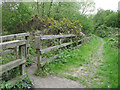
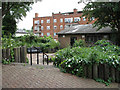
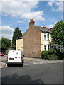


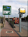
100 photos from this area
Area Information
Key information about the N2 8HN including its size, population, and administrative classification.
- Area Type
- Postcode
- Area Size
- 1.3 hectares
- Population
- 1722
- Population Density
- 7834 people/km²
House Prices in N2 8HN
72
Properties
£536,200
Average Sold Price
£101,000
Lowest Price
£1,150,000
Highest Price
Showing 72 properties
| Address | Type | Beds | Baths | Last Sale Price | Last Sale Date | |
|---|---|---|---|---|---|---|
| 39 Sylvester Road, East Finchley, London, N2 8HN | Semi-detached | 4 | 1 | £800,000 | Jul 2024 | |
| 46 Sylvester Road, East Finchley, London, N2 8HN | Semi-detached | 4 | 2 | £937,500 | May 2024 | |
| 43 Sylvester Road, East Finchley, London, N2 8HN | Semi-detached | 5 | 2 | £1,020,000 | Aug 2023 | |
| 13 Sylvester Road, East Finchley, London, N2 8HN | Terraced | 4 | 2 | £1,150,000 | Jan 2023 | |
| 56 Sylvester Road, East Finchley, London, N2 8HN | Detached | 3 | 1 | £910,000 | Sep 2022 | |
| 30 Sylvester Road, East Finchley, London, N2 8HN | Retail | 3 | 1 | £900,000 | Apr 2022 | |
| 2 Sylvester Road, East Finchley, London, N2 8HN | Semi-detached | 3 | 1 | £742,500 | Jan 2021 | |
| 21 Sylvester Road, East Finchley, London, N2 8HN | Terraced | 3 | 2 | £610,000 | Sep 2020 | |
| 49 Sylvester Road, East Finchley, London, N2 8HN | Semi-detached | 5 | 3 | £900,000 | Aug 2020 | |
| 38 Sylvester Road, East Finchley, London, N2 8HN | Semi-detached | 3 | 2 | £727,500 | Feb 2019 |
Page 1 of 8
Energy Efficiency in N2 8HN
Amenities
Schools
| Rank | School | Type | Entry gender | Ages |
|---|
Explore more schools in this area
Go to Schools tabDemographics
Household Size
One person
most common
Accommodation Type
Flats
most common
Tenure
35
majority
Ethnic Group
White
most common
Religion
N/A
most common
Household Composition
N/A
most common
Age
47
median
Adults (30-64 years)
most common
Household Deprivation
N/A
with no deprivation
NS-SEC
31
in Lower managerial occupations
Explore more demographic insights in this area
Go to Demographics tabPlanning
Planning Constraints
- Flood RiskPremium
- Ramsar Wetland SitesPremium
- Area of Outstanding Natural BeautyPremium
- Protected Nature ReservePremium
- Protected WoodlandPremium