Area Overview for N2 0SQ
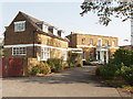
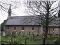
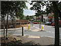
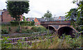
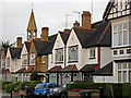
Photos of N2 0SQ


Area Information
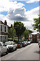
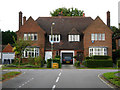
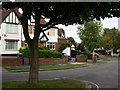
Living in N2 0SQ means inhabiting a tightly packed residential cluster in north London, where 1,789 people reside across just 1,626 square metres. This makes it one of the most densely populated areas in England, with 110,000 people per square kilometre. The area’s compact nature reflects its character as a mature neighbourhood, dominated by flats and home-owners aged 30–64. Daily life here is shaped by proximity to transport hubs, with East Finchley and Finchley Central stations offering easy access to the city. The presence of Bishop Douglass School Finchley, rated good by Ofsted, adds to the appeal for families. While the area lacks green spaces or natural constraints, its high connectivity and low crime risk—scoring 82/100—make it a practical choice for those prioritising convenience over open space. N2 0SQ is not for those seeking isolation; it thrives on proximity to retail, transport, and community amenities within walking distance.
- Area Type
- Postcode
- Area Size
- 1626 m²
- Population
- 1789
- Population Density
- 12476 people/km²
The property market in N2 0SQ is dominated by flats, with home ownership at 59%, indicating a mix of owner-occupied and rental properties. Given the area’s small size and high density, the housing stock is limited, making it a competitive market for buyers. Flats here are likely to be smaller, designed for single occupants or couples, reflecting the age profile of the population. While the data does not specify rental rates, the high home ownership suggests that many properties are long-term investments rather than short-term lets. Buyers should consider the compact nature of the area and its proximity to transport, which may influence property values. The absence of larger family homes or detached properties means this is not a market for those seeking expansive living spaces.
House Prices in N2 0SQ
No properties found in this postcode.
Energy Efficiency in N2 0SQ
Residents of N2 0SQ have access to a range of amenities within walking distance. Retail options include Tesco East, M&S Byron Finchley BP, and Co-op Falloden, catering to daily shopping needs. The area’s transport links to East Finchley and Finchley Central stations make commuting straightforward, while rail services to New Southgate and Alexandra Palace offer alternative routes. Ferry stops at Camden Lock and Little Venice provide scenic travel options. The presence of multiple stations and shops suggests a vibrant, convenience-driven lifestyle. While there are no named parks or leisure facilities in the data, the proximity to London Zoo and Alexandra Palace hints at recreational opportunities nearby. The area’s compact layout ensures that essentials are never far, though larger amenities may require a short journey.
Amenities
Schools
N2 0SQ is served by Bishop Douglass School Finchley, which operates as both a primary school and an academy with a good Ofsted rating. This dual role provides families with a seamless transition from early education to secondary schooling within the same institution. The school’s rating indicates a standard of teaching and facilities that meet or exceed national benchmarks. For parents, this reduces the need to seek private education or travel long distances for schooling. The presence of a single school with multiple roles suggests a focused educational environment, though the data does not mention other schools in the area. Families prioritising academic quality and convenience will find this a key asset of N2 0SQ.
| Rank | School | Type | Entry gender | Ages |
|---|
Explore more schools in this area
Go to Schools tabDemographics
N2 0SQ’s population of 1,789 is predominantly adults aged 30–64, with a median age of 47. Nearly 60% of residents own their homes, a figure that suggests stability in an area where 59% of housing is in flats. The demographic profile indicates a mature, established community, with the White ethnic group forming the majority. The high population density—110,000 people per square kilometre—means living spaces are compact, and shared amenities are essential. This density also reflects the area’s role as a commuter hub, with residents likely balancing work in central London with the relative affordability of north-west London. The lack of younger households or student populations suggests a focus on long-term residency rather than transient living.
Household Size
Accommodation Type
Tenure
Ethnic Group
Religion
Household Composition
Age
Household Deprivation
NS-SEC
Explore more demographic insights in this area
Go to Demographics tabPlanning
Planning Constraints
- Flood RiskPremium
- Ramsar Wetland SitesPremium
- Area of Outstanding Natural BeautyPremium
- Protected Nature ReservePremium
- Protected WoodlandPremium