Area Overview for N2 0RU
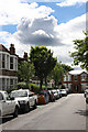
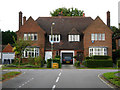
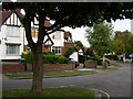
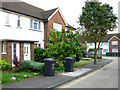
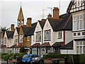
Photos of N2 0RU


Area Information
N2 0RU is a compact residential postcode in north London, spanning just 5,223 square metres and home to 1,522 residents. Its high population density—291,413 people per square kilometre—reflects a tightly knit community, though the area’s small size means it’s more of a cluster than a sprawling suburb. The postcode lies near key transport hubs, including East Finchley and Finchley Central stations, which connect residents to central London and beyond. Daily life here is shaped by proximity to retail, dining, and transport, with nearby supermarkets like Tesco East and Co-op Falloden within walking distance. The area’s median age of 47 suggests a stable population, with a strong presence of adults aged 30–64. While it lacks large green spaces, its accessibility to parks via nearby stations and ferries offers a balance of urban convenience and outdoor access. For buyers, N2 0RU’s appeal lies in its compactness, strong transport links, and proximity to essential services, though its limited size means housing options are focused on flats rather than larger homes.
- Area Type
- Postcode
- Area Size
- 5223 m²
- Population
- 1522
- Population Density
- 6580 people/km²
The property market in N2 0RU is defined by its high density and limited space, with flats making up the majority of accommodation types. Home ownership rates of 57% suggest a balance between owner-occupied properties and rental units, though the small area size means housing stock is constrained. This makes the area more suited to buyers seeking compact, urban living rather than larger homes. The prevalence of flats indicates a focus on efficiency, which aligns with the proximity to transport links and retail amenities. However, the limited size of N2 0RU means buyers should consider nearby areas for more options. For those prioritising convenience over space, the area’s compactness offers easy access to schools, shops, and public transport, but the lack of larger housing types may be a drawback for growing families or those seeking more space.
House Prices in N2 0RU
Showing 1 properties
| Address | Type | Beds | Baths | Last Sale Price | Last Sale Date | |
|---|---|---|---|---|---|---|
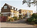
| Nazareth House, 162 East End Road, Finchley, London, N2 0RU | Retirement | - | - | - | - |
Energy Efficiency in N2 0RU
Daily life in N2 0RU is shaped by its proximity to retail, dining, and transport hubs. The area’s retail options include supermarkets like Tesco East, Co-op Falloden, and Iceland East, ensuring access to groceries and everyday essentials. Nearby stations such as East Finchley and Finchley Central connect residents to a wider network of shops, restaurants, and services across north London. While the area itself lacks large parks, its transport links provide access to green spaces like Hampstead Heath via rail or ferry. The presence of multiple ferry stops also opens up leisure opportunities on the Thames. This mix of convenience and accessibility makes N2 0RU suitable for those who prioritise urban living with easy access to both retail and outdoor spaces.
Amenities
Schools
The nearest schools to N2 0RU include Oak Lodge School, which is designated as a special school. While the data lists the same school twice, it appears to be the primary educational institution in the area. As a special school, it caters to students with specific needs, which may be important for families with children requiring tailored support. The absence of mainstream schools in the data means it’s unclear whether the area offers a full range of educational options. Families should consider the proximity of other schools outside N2 0RU, particularly if they require a mix of primary, secondary, or alternative education settings. The presence of a special school highlights the area’s focus on inclusive education but may not meet the needs of all households.
| Rank | School | Type | Entry gender | Ages |
|---|
Explore more schools in this area
Go to Schools tabDemographics
The population of N2 0RU is predominantly adults aged 30–64, with a median age of 47. This suggests a mature, established community with a strong presence of middle-aged residents. Home ownership rates stand at 57%, indicating a mix of owner-occupied properties and rental units. The accommodation type is largely flats, reflecting the area’s compact nature and limited space for larger housing stock. The predominant ethnic group is White, though specific data on diversity is not provided. With a population density of 291,413 people per square kilometre, the area is highly concentrated, which may influence the character of local interactions and community dynamics. The absence of detailed deprivation data means quality of life factors like access to services or employment opportunities are not explicitly quantified, but the proximity to retail and transport hubs suggests these needs are met.
Household Size
Accommodation Type
Tenure
Ethnic Group
Religion
Household Composition
Age
Household Deprivation
NS-SEC
Explore more demographic insights in this area
Go to Demographics tabPlanning
Planning Constraints
- Flood RiskPremium
- Ramsar Wetland SitesPremium
- Area of Outstanding Natural BeautyPremium
- Protected Nature ReservePremium
- Protected WoodlandPremium