Area Overview for N2 0BQ
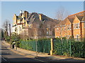
Photos of N2 0BQ


Area Information
Living in N2 0BQ means inhabiting a compact, residential postcode area in England with a population of 1,501 people spread across a densely populated space. The area’s small size creates a tightly knit community, where daily life is shaped by proximity to amenities and transport links. With a population density of 1,136 people per square kilometre, the area is clearly urban, yet retains a residential character defined by houses rather than flats. The median age of 47 suggests a mature population, with the majority of residents falling within the 30–64 age range. This demographic profile indicates a community of established professionals and families, contributing to a stable, low-turnover housing market. The area’s location near major transport hubs and schools positions it as a practical choice for those seeking a balance between urban convenience and residential tranquillity. While the population is small, the density and accessibility to nearby services make N2 0BQ a functional part of London’s north-western corridor.
- Area Type
- Postcode
- Area Size
- Not available
- Population
- 1501
- Population Density
- 1136 people/km²
The property market in N2 0BQ is characterised by a high rate of home ownership (74%) and a predominance of houses over flats or apartments. This suggests a market skewed towards owner-occupied properties, with limited rental availability. The small postcode area’s housing stock is likely constrained by its size, meaning buyers must consider nearby areas for broader options. The focus on houses indicates a preference for family-friendly or long-term living, which may appeal to professionals seeking stability. However, the compact nature of N2 0BQ means the local market is not expansive, and property values may be influenced more by proximity to transport and schools than by the size of the area itself. Buyers should also consider the limited number of properties available, which could affect competition and price trends.
House Prices in N2 0BQ
No properties found in this postcode.
Energy Efficiency in N2 0BQ
Residents of N2 0BQ enjoy a range of amenities within walking or short transit distance. Retail options include Co-op Falloden, Tesco Highgate, and Sainsburys Golders, offering everyday shopping convenience. The area’s proximity to metro stations like East Finchley and Highgate, as well as rail services at Hampstead Heath and Gospel Oak, ensures easy access to London’s broader transport network. Ferry stops such as Camden Lock Waterbus and Little Venice Waterbus Stop provide alternative routes, particularly for leisure travel. Bus services connect to major hubs like London Victoria Coach Station, enhancing mobility. The mix of retail, transport, and water-based connectivity contributes to a dynamic lifestyle, blending urban practicality with recreational opportunities.
Amenities
Schools
Residents of N2 0BQ have access to two independent schools: The King Alfred School and Annemount School. Both institutions are private, offering an alternative to state education. The presence of independent schools may attract families seeking specific educational philosophies or curricula. However, no Ofsted ratings or academic performance data are provided, so it is unclear how these schools compare to state-run options in the area. The availability of independent education reflects the area’s demographic profile, which includes a significant proportion of adults aged 30–64, likely parents prioritising school choice. Families considering N2 0BQ should visit these schools directly to assess their suitability for their children’s needs.
| Rank | School | Type | Entry gender | Ages |
|---|
Explore more schools in this area
Go to Schools tabDemographics
The community in N2 0BQ is predominantly composed of adults aged 30–64, with a median age of 47. This suggests a mature population, likely with established careers and family structures. Home ownership is high at 74%, indicating a strong presence of owner-occupied properties rather than rental units. The accommodation type is primarily houses, which aligns with the area’s residential character. The predominant ethnic group is White, though no specific data on diversity or deprivation is provided. The age profile and home ownership rate suggest a community that values stability and long-term residency. With no data on income distribution or deprivation levels, it is difficult to assess socioeconomic variation, but the high home ownership rate implies a relatively secure financial environment for residents.
Household Size
Accommodation Type
Tenure
Ethnic Group
Religion
Household Composition
Age
Household Deprivation
NS-SEC
Explore more demographic insights in this area
Go to Demographics tabPlanning
Planning Constraints
- Flood RiskPremium
- Ramsar Wetland SitesPremium
- Area of Outstanding Natural BeautyPremium
- Protected Nature ReservePremium
- Protected WoodlandPremium