Area Overview for N19 5YF
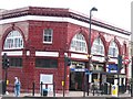
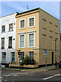
Photos of N19 5YF


Area Information
Living in N19 5YF means inhabiting a small, defined residential cluster in north London, where the population of 1,611 reflects a tight-knit community. This area is characterised by its compact nature, with a focus on accessibility to urban amenities while retaining a quieter, more residential feel. The median age of 47 suggests a mature demographic, with the majority of residents falling within the 30-64 age range. Daily life here is shaped by proximity to transport hubs, retail outlets, and schools, making it practical for commuters and families alike. The area’s layout, dominated by flats, indicates a mix of long-term residents and those seeking urban living without the sprawl of larger suburbs. While N19 5YF lacks natural landscapes or protected sites, its strategic position near major transport routes and retail corridors ensures convenience. For those considering a move, this postcode offers a balance of urban connectivity and manageable living, though its small size means the immediate surroundings are key to understanding its full character.
- Area Type
- Postcode
- Area Size
- Not available
- Population
- 1611
- Population Density
- 15535 people/km²
The property market in N19 5YF is defined by its high proportion of rental properties, with only 26% of homes owned by residents. This indicates a market skewed towards tenants rather than owner-occupiers, which is typical of urban areas with limited housing stock. The accommodation type is predominantly flats, reflecting a need for space-efficient living in a densely populated zone. For buyers, this suggests that available properties are likely to be leasehold rather than freehold, with potential implications for long-term costs and restrictions. The small size of the area means that property choices are limited, and those seeking to purchase may need to consider nearby postcode areas for more options. The lack of protected land or planning constraints also means development pressure is unlikely to impact the market significantly. However, the rental demand suggests strong occupancy rates, which could influence property values and availability for buyers.
House Prices in N19 5YF
No properties found in this postcode.
Energy Efficiency in N19 5YF
Residents of N19 5YF have access to a range of amenities within walking or short transit distance. Retail options include Sainsburys Fortess, Budgens Tufnell, and Co-op Fortress, providing everyday shopping needs. The area’s transport links also connect to major hubs like London Victoria Coach Station, making it easy to reach further destinations. While no parks or leisure facilities are named in the data, the presence of ferry stops near London Zoo and Little Venice suggests proximity to recreational spaces. The mix of retail, transport, and commuter services creates a practical lifestyle, ideal for those who prioritise convenience over sprawling amenities. However, the absence of specific cultural or leisure venues means the area’s character is defined more by its functionality than by unique local attractions.
Amenities
Schools
The Bridge School is the only named school listed near N19 5YF, and it is designated as a special school. No Ofsted rating is provided, so its educational quality cannot be assessed directly. The presence of a special school suggests that the area may cater to families with children requiring tailored support, though the absence of mainstream schools like primary or secondary institutions means families may need to look beyond the immediate vicinity for broader educational options. This could be a consideration for parents seeking a range of school types, as the current data highlights only one establishment. The lack of additional schools in the data implies that N19 5YF is not a primary destination for families prioritising a diverse school catchment.
| Rank | School | Type | Entry gender | Ages |
|---|
Explore more schools in this area
Go to Schools tabDemographics
The community in N19 5YF is predominantly composed of adults aged 30-64, with a median age of 47. This suggests a stable population with established careers and families, though the 26% home ownership rate indicates that many residents are renters rather than property owners. The accommodation type is largely flats, reflecting a preference for urban living or a response to space constraints. The predominant ethnic group is White, though no further breakdown of diversity is provided. The absence of specific data on deprivation or income levels means the quality of life here cannot be fully assessed, but the age profile implies a mix of active professionals and retirees. The area’s demographics suggest a focus on practical living, with little evidence of younger families or transient populations. This profile aligns with the presence of nearby schools and transport links, catering to a community that prioritises accessibility over other factors.
Household Size
Accommodation Type
Tenure
Ethnic Group
Religion
Household Composition
Age
Household Deprivation
NS-SEC
Explore more demographic insights in this area
Go to Demographics tabPlanning
Planning Constraints
- Flood RiskPremium
- Ramsar Wetland SitesPremium
- Area of Outstanding Natural BeautyPremium
- Protected Nature ReservePremium
- Protected WoodlandPremium