Area Overview for N19 5TG
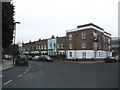
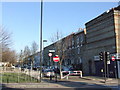
Photos of N19 5TG


Area Information
Living in N19 5TG means being part of a compact residential cluster in north London, where daily life is shaped by proximity to transport hubs and local amenities. With a population of 1,645, the area is small but well-connected, offering a mix of practical living and urban convenience. The community is predominantly adults aged 30–64, with a median age of 47, suggesting a mature demographic focused on stability. Residents benefit from nearby schools, retail outlets, and multiple transport links, including rail, metro, and bus services. While the area lacks large green spaces or natural constraints, its accessibility to London’s broader infrastructure makes it appealing for commuters. The housing stock is largely flats, reflecting a rental-heavy market, though some properties may be owner-occupied. N19 5TG is not a sprawling suburb but a tightly knit postcode where convenience often trumps space, ideal for those prioritising connectivity over expansive living areas.
- Area Type
- Postcode
- Area Size
- Not available
- Population
- 1645
- Population Density
- 17047 people/km²
The property market in N19 5TG is characterised by a low home ownership rate of 19%, suggesting that the area is more rental-focused than owner-occupied. The predominant accommodation type is flats, which is typical for smaller, densely populated postcodes. This housing stock likely reflects a mix of purpose-built apartments and converted properties, catering to tenants rather than buyers. Given the small size of the area, property availability is limited, and the market may be competitive for those seeking to purchase. For buyers, the focus would likely be on flats within the immediate vicinity, though the lack of detailed data on property prices or availability means that the market’s specifics remain unclear. The low ownership rate also implies that landlords may play a significant role in shaping the local real estate landscape.
House Prices in N19 5TG
No properties found in this postcode.
Energy Efficiency in N19 5TG
Residents of N19 5TG have access to a range of amenities within practical reach, including retail outlets such as Iceland Archway, Sainsburys Archway, and M&S Archway. These stores offer everyday shopping convenience, from groceries to clothing. The area’s transport links also grant access to broader leisure opportunities, such as the nearby London Zoo Waterbus Stop and Little Venice Waterbus Stop, which connect to cultural and recreational sites. While specific parks or leisure facilities are not detailed in the data, the presence of multiple rail, metro, and bus services suggests that residents can easily reach green spaces, restaurants, and other attractions in surrounding areas. The mix of retail, transport, and water-based amenities contributes to a lifestyle that balances local convenience with urban accessibility, making daily life in N19 5TG both practical and connected.
Amenities
Schools
The nearest school to N19 5TG is Hargrave Park Primary School, a primary institution with an Ofsted rating of ‘good’. This school serves the local community, offering education for younger children in the area. As the only named school in the data, it highlights that the area’s educational options are limited to primary-level institutions. Families with older children may need to look further afield for secondary education, which is not specified in the data. The ‘good’ Ofsted rating indicates that the school meets acceptable standards, though no further details on its curriculum, performance, or facilities are provided. For parents prioritising proximity to schools, Hargrave Park Primary is a key consideration, but the absence of secondary schools may influence decisions for larger families.
| Rank | School | Type | Entry gender | Ages |
|---|
Explore more schools in this area
Go to Schools tabDemographics
The population of N19 5TG is 1,645, with a median age of 47, indicating a mature community. The most common age range is adults between 30 and 64 years, suggesting a demographic focused on established careers and family life. Home ownership in the area is low, at just 19%, implying that most residents rent their homes. The predominant accommodation type is flats, which aligns with the small, residential nature of the postcode. The predominant ethnic group is White, though no specific data on diversity or deprivation levels is provided. This suggests a relatively homogenous community, though further details on socioeconomic factors are not available. The age profile and housing type indicate a population that may be more transient, with a reliance on rental properties rather than long-term ownership.
Household Size
Accommodation Type
Tenure
Ethnic Group
Religion
Household Composition
Age
Household Deprivation
NS-SEC
Explore more demographic insights in this area
Go to Demographics tabPlanning
Planning Constraints
- Flood RiskPremium
- Ramsar Wetland SitesPremium
- Area of Outstanding Natural BeautyPremium
- Protected Nature ReservePremium
- Protected WoodlandPremium