Area Overview for N19 5RL
Photos of N19 5RL


Area Information
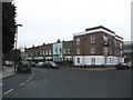
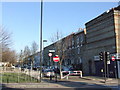
Living in N19 5RL offers a compact, residential experience within a small cluster of homes. With a population of 1,645, the area is characterised by its proximity to transport hubs and local amenities, making it convenient for those seeking connectivity without the density of central London. The postcode is served by multiple rail, metro, and bus routes, including Upper Holloway Station and Tufnell Park Station, which link to wider London networks. Daily life here is shaped by its mix of practical living and accessibility. The area’s demographics suggest a mature population, with a median age of 47 and most residents aged 30–64. While home ownership is low at 19%, the accommodation is primarily flats, reflecting a rental-dominated market. Families and professionals may find the area appealing for its balance of affordability and proximity to schools like Hargrave Park Primary School, which holds a good Ofsted rating. However, the small size of N19 5RL means its character is defined by its immediate surroundings, with limited scope for expansion or development.
- Area Type
- Postcode
- Area Size
- Not available
- Population
- 1645
- Population Density
- 17047 people/km²
The property market in N19 5RL is shaped by its small size and high proportion of rented flats. With only 19% of homes owned by residents, the area functions largely as a rental market, which may limit opportunities for buyers seeking long-term investment. The dominance of flats indicates a housing stock that is likely older, with limited scope for major redevelopment. This could mean that properties here are smaller and more suited to individuals or couples rather than growing families. For buyers, the market’s compact nature means competition is concentrated within a narrow geographic area, and prices may be influenced more by location-specific factors—such as proximity to transport—than by broader trends. The low home ownership rate also suggests that many residents view the area as a temporary or transitional choice, which could affect property values and demand.
House Prices in N19 5RL
No properties found in this postcode.
Energy Efficiency in N19 5RL
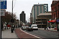
The lifestyle in N19 5RL is defined by its proximity to a range of amenities, from retail to transport. Local shops include Iceland Archway, Sainsburys Archway, and M&S Archway, providing everyday essentials within walking distance. The area’s transport network is extensive, with rail, metro, ferry, and bus services connecting residents to London’s key hubs. For example, Upper Holloway Station and Tufnell Park Station offer easy access to the city, while the nearby London Victoria Coach Station provides links to national routes. The presence of waterbus stops like Camden Lock and Little Venice adds a unique dimension to mobility, particularly for those near the River Thames. These amenities contribute to a convenient, dynamic lifestyle, where daily errands and travel are efficiently managed. The compact nature of the area means residents can access most services without long commutes, enhancing the overall quality of life.
Amenities
Schools
The nearest school to N19 5RL is Hargrave Park Primary School, which serves the local community with a good Ofsted rating. This primary school is a key asset for families in the area, offering a reliable educational foundation for younger children. However, the data does not provide information on secondary schools or other educational institutions nearby. The presence of a well-rated primary school may make N19 5RL attractive to families prioritising early education, though buyers should consider whether secondary schooling options align with their needs. The single school listed highlights the area’s limited educational infrastructure, which could be a factor for those requiring a broader range of school choices.
| Rank | School | Type | Entry gender | Ages |
|---|
Explore more schools in this area
Go to Schools tabDemographics
The community in N19 5RL is predominantly composed of adults aged 30–64, with a median age of 47. This suggests a mature, settled population, likely with established careers and families. Home ownership is notably low at 19%, indicating that most residents rent their homes. The accommodation type is primarily flats, which aligns with the area’s compact nature and limited land availability. The predominant ethnic group is White, though specific data on diversity or deprivation is not provided. The age profile implies a community focused on stability, with fewer young families or retirees compared to other areas. The low home ownership rate may reflect the area’s role as a transitional or rental-focused zone, where residents prioritise location over property investment. For buyers, this demographic profile suggests a market where demand is driven by proximity to transport and amenities rather than long-term residency.
Household Size
Accommodation Type
Tenure
Ethnic Group
Religion
Household Composition
Age
Household Deprivation
NS-SEC
Explore more demographic insights in this area
Go to Demographics tabPlanning
Planning Constraints
- Flood RiskPremium
- Ramsar Wetland SitesPremium
- Area of Outstanding Natural BeautyPremium
- Protected Nature ReservePremium
- Protected WoodlandPremium