Area Overview for N19 5PL
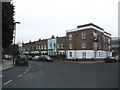
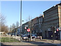
Photos of N19 5PL


Area Information
Living in N19 5PL offers a compact, residential experience shaped by its small cluster of homes and proximity to London’s transport networks. With a population of 1,846, the area feels intimate, catering to a mature demographic. The median age of 47 suggests a community of established professionals and families, many of whom are in the 30–64 age range. Daily life here is defined by convenience: nearby schools, shops, and transport links make it easy to balance work, family, and leisure. The postcode’s limited size means residents are close to key amenities, though the housing stock is predominantly flats, reflecting a rental-oriented market. While the area lacks sprawling green spaces, its connectivity to London’s rail, metro, and waterbus routes ensures access to the city’s cultural and economic hubs. For those prioritising practicality over space, N19 5PL provides a functional base with minimal commute times to central London. The presence of two outstanding primary schools further cements its appeal for families seeking quality education without long travel times.
- Area Type
- Postcode
- Area Size
- Not available
- Population
- 1846
- Population Density
- 8768 people/km²
The property market in N19 5PL is characterised by a low home ownership rate of 30%, suggesting that the area functions more as a rental market than an owner-occupied one. The predominant accommodation type is flats, which aligns with the compact nature of the postcode and its proximity to London’s transport networks. This housing stock is likely to appeal to professionals or families seeking manageable, centrally located living spaces. However, the small size of the area means the available properties are limited, and buyers may need to consider nearby postcodes for more options. The focus on flats also implies a lack of larger homes or detached properties, which could be a drawback for those seeking more space. For investors or first-time buyers, the market’s rental orientation and limited stock mean competition may be fierce, requiring a strategic approach to property selection.
House Prices in N19 5PL
No properties found in this postcode.
Energy Efficiency in N19 5PL
The lifestyle in N19 5PL is shaped by its proximity to a variety of shops, transport hubs, and leisure options. Local retail includes major names such as Iceland Archway, Sainsburys Archway, and M&S Archway, providing convenient access to groceries, clothing, and household goods. The area’s transport links extend beyond commuting, with waterbus stops at Camden Lock and Little Venice offering leisurely canal trips. For those seeking more extensive travel, nearby coach stations like London Victoria and Green Line provide connections to destinations across the UK. While the area lacks large parks or recreational spaces, its density ensures that essential amenities are within walking distance. The blend of retail, transport, and water-based leisure options creates a dynamic daily life, ideal for those prioritising convenience and connectivity over expansive green spaces.
Amenities
Schools
Residents of N19 5PL have access to two primary schools within practical reach: St Joseph’s Catholic Primary School and St Aloysius RC College. Both institutions serve the local community, with St Joseph’s holding an Ofsted rating of outstanding and St Aloysius rated as good. The presence of two primary schools reduces travel times for families and ensures a range of educational options. St Joseph’s, in particular, offers a high standard of education, which could be a key factor for parents prioritising academic excellence. The proximity of these schools to homes in N19 5PL makes the area attractive for families seeking reliable, locally based education without the need for long commutes. The mix of Catholic and secular institutions also reflects the area’s diverse religious and cultural landscape, though specific data on school catchment areas or pupil demographics is not provided.
| Rank | School | Type | Entry gender | Ages |
|---|
Explore more schools in this area
Go to Schools tabDemographics
The community in N19 5PL is predominantly composed of adults aged 30–64, with a median age of 47. This suggests a mature population, likely comprising professionals and families in stable employment. Home ownership is relatively low at 30%, indicating that a significant portion of residents rent their properties. The accommodation type is primarily flats, reflecting a housing stock suited to smaller households or those preferring urban living. The predominant ethnic group is White, though specific data on diversity or deprivation is not provided. The age profile implies a community with established careers and family structures, which may influence local services and amenities. With no data on income distribution or deprivation levels, it is unclear how economic factors shape the area’s quality of life. However, the demographic stability suggests a consistent demand for housing and services tailored to middle-aged residents.
Household Size
Accommodation Type
Tenure
Ethnic Group
Religion
Household Composition
Age
Household Deprivation
NS-SEC
Explore more demographic insights in this area
Go to Demographics tabPlanning
Planning Constraints
- Flood RiskPremium
- Ramsar Wetland SitesPremium
- Area of Outstanding Natural BeautyPremium
- Protected Nature ReservePremium
- Protected WoodlandPremium