Area Overview for N19 5NJ
Photos of N19 5NJ

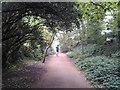
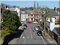
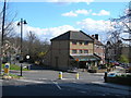
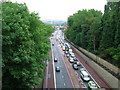
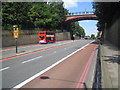
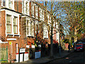
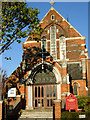
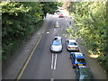
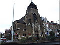
100 photos from this area
Area Information
Key information about the N19 5NJ including its size, population, and administrative classification.
- Area Type
- Postcode
- Area Size
- 4052 m²
- Population
- 1846
- Population Density
- 8768 people/km²
House Prices in N19 5NJ
50
Properties
£936,964
Average Sold Price
£325,000
Lowest Price
£1,770,000
Highest Price
Showing 50 properties
| Address | Type | Beds | Baths | Last Sale Price | Last Sale Date | |
|---|---|---|---|---|---|---|
| 11 Waterlow Road, London, N19 5NJ | Terraced | 4 | - | £1,500,000 | Feb 2025 | |
| 23 Waterlow Road, London, N19 5NJ | Terraced | 6 | 2 | £1,770,000 | Dec 2024 | |
| 25 Waterlow Road, London, N19 5NJ | Terraced | 5 | 3 | £1,265,000 | Jun 2024 | |
| 31 Waterlow Road, London, N19 5NJ | house | - | - | £1,100,000 | Dec 2023 | |
| 29 Waterlow Road, London, N19 5NJ | house | 4 | - | £1,625,000 | Mar 2023 | |
| 49 Waterlow Road, London, N19 5NJ | Flat | 1 | 1 | £1,325,000 | Sep 2022 | |
| 37 Waterlow Road, London, N19 5NJ | house | - | - | £1,030,000 | Mar 2019 | |
| Flat 4, 1A Waterlow Road, London, N19 5NJ | Flat | 1 | 1 | £325,000 | Sep 2018 | |
| 9 Waterlow Road, London, N19 5NJ | Terraced | 4 | 2 | £930,000 | Jan 2017 | |
| 47 Waterlow Road, London, N19 5NJ | house | - | - | £620,000 | Apr 2010 |
Page 1 of 5
Energy Efficiency in N19 5NJ
Amenities
Schools
| Rank | School | Type | Entry gender | Ages |
|---|
Explore more schools in this area
Go to Schools tabDemographics
Household Size
One person
most common
Accommodation Type
Flats
most common
Tenure
30
majority
Ethnic Group
White
most common
Religion
N/A
most common
Household Composition
N/A
most common
Age
47
median
Adults (30-64 years)
most common
Household Deprivation
N/A
with no deprivation
NS-SEC
52
in Lower managerial occupations
Explore more demographic insights in this area
Go to Demographics tabPlanning
Planning Constraints
- Flood RiskPremium
- Ramsar Wetland SitesPremium
- Area of Outstanding Natural BeautyPremium
- Protected Nature ReservePremium
- Protected WoodlandPremium