Area Overview for N19 5EU
Photos of N19 5EU
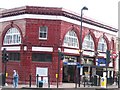

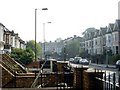


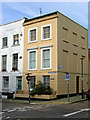
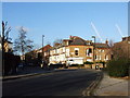


100 photos from this area
Area Information
Key information about the N19 5EU including its size, population, and administrative classification.
- Area Type
- Postcode
- Area Size
- 7180 m²
- Population
- 1849
- Population Density
- 13815 people/km²
House Prices in N19 5EU
56
Properties
£1,151,384
Average Sold Price
£213,000
Lowest Price
£2,400,000
Highest Price
Showing 56 properties
| Address | Type | Beds | Baths | Last Sale Price | Last Sale Date | |
|---|---|---|---|---|---|---|
| 28 Hugo Road, London, N19 5EU | Maisonette | 4 | 2 | £1,345,000 | Mar 2025 | |
| 9 Hugo Road, London, N19 5EU | Detached | 4 | 2 | £1,825,000 | Jul 2024 | |
| 18A Hugo Road, London, N19 5EU | Flat | - | - | £430,000 | Apr 2023 | |
| 19A Hugo Road, London, N19 5EU | Detached | 5 | 2 | £645,000 | Feb 2022 | |
| 27 Hugo Road, London, N19 5EU | house | 4 | 2 | £1,500,000 | Jan 2022 | |
| 7 Hugo Road, London, N19 5EU | house | - | - | £1,722,000 | Sep 2021 | |
| 35 Hugo Road, London, N19 5EU | house | - | - | £2,400,000 | Aug 2021 | |
| 20 Hugo Road, London, N19 5EU | house | - | - | £1,599,950 | Jun 2021 | |
| 4 Hugo Road, London, N19 5EU | Maisonette | 4 | 1 | £975,000 | Jul 2019 | |
| 10 Hugo Road, London, N19 5EU | Terraced | 3 | 1 | £1,212,000 | Jan 2019 |
Page 1 of 6
Energy Efficiency in N19 5EU
Amenities
Schools
| Rank | School | Type | Entry gender | Ages |
|---|
Explore more schools in this area
Go to Schools tabDemographics
Household Size
Two person
most common
Accommodation Type
Flats
most common
Tenure
52
majority
Ethnic Group
White
most common
Religion
N/A
most common
Household Composition
N/A
most common
Age
47
median
Adults (30-64 years)
most common
Household Deprivation
N/A
with no deprivation
NS-SEC
61
in Lower managerial occupations
Explore more demographic insights in this area
Go to Demographics tabPlanning
Planning Constraints
- Flood RiskPremium
- Ramsar Wetland SitesPremium
- Area of Outstanding Natural BeautyPremium
- Protected Nature ReservePremium
- Protected WoodlandPremium