Area Overview for N19 5DY
Photos of N19 5DY

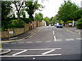
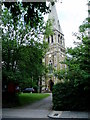
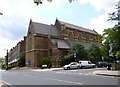
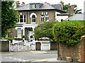
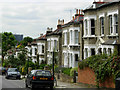
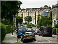
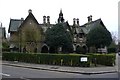
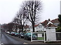
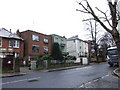
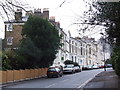
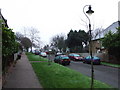
100 photos from this area
Area Information
Key information about the N19 5DY including its size, population, and administrative classification.
- Area Type
- Postcode
- Area Size
- 5736 m²
- Population
- 1645
- Population Density
- 17047 people/km²
House Prices in N19 5DY
56
Properties
£281,844
Average Sold Price
£35,000
Lowest Price
£683,000
Highest Price
Showing 56 properties
| Address | Type | Beds | Baths | Last Sale Price | Last Sale Date | |
|---|---|---|---|---|---|---|
| 227 Salisbury Walk, London, N19 5DY | Maisonette | - | - | £683,000 | Oct 2024 | |
| 262 Salisbury Walk, London, N19 5DY | Flat | - | - | £450,000 | Oct 2024 | |
| 272 Salisbury Walk, London, N19 5DY | Flat | 2 | 1 | £426,000 | Sep 2022 | |
| 256 Salisbury Walk, London, N19 5DY | Flat | 2 | 1 | £417,500 | May 2021 | |
| 239 Salisbury Walk, London, N19 5DY | Flat | - | - | £395,000 | Aug 2015 | |
| 250 Salisbury Walk, London, N19 5DY | Flat | - | - | £225,000 | Jan 2013 | |
| 223 Salisbury Walk, London, N19 5DY | Maisonette | - | - | £345,000 | Jun 2012 | |
| 265 Salisbury Walk, London, N19 5DY | Flat | - | - | £193,000 | Mar 2012 | |
| 225 Salisbury Walk, London, N19 5DY | Flat | - | - | £212,000 | Dec 2010 | |
| 274 Salisbury Walk, London, N19 5DY | Flat | 2 | 1 | £189,000 | Jul 2010 |
Page 1 of 6
Energy Efficiency in N19 5DY
Amenities
Schools
| Rank | School | Type | Entry gender | Ages |
|---|
Explore more schools in this area
Go to Schools tabDemographics
Household Size
One person
most common
Accommodation Type
Flats
most common
Tenure
19
majority
Ethnic Group
White
most common
Religion
N/A
most common
Household Composition
N/A
most common
Age
47
median
Adults (30-64 years)
most common
Household Deprivation
N/A
with no deprivation
NS-SEC
30
in Lower managerial occupations
Explore more demographic insights in this area
Go to Demographics tabPlanning
Planning Constraints
- Flood RiskPremium
- Ramsar Wetland SitesPremium
- Area of Outstanding Natural BeautyPremium
- Protected Nature ReservePremium
- Protected WoodlandPremium