Area Overview for N19 5DP
Photos of N19 5DP


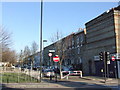
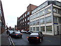
100 photos from this area
Area Information
Key information about the N19 5DP including its size, population, and administrative classification.
- Area Type
- Postcode
- Area Size
- 4588 m²
- Population
- 1645
- Population Density
- 17047 people/km²
House Prices in N19 5DP
63
Properties
£284,550
Average Sold Price
£100,000
Lowest Price
£500,000
Highest Price
Showing 63 properties
| Address | Type | Beds | Baths | Last Sale Price | Last Sale Date | |
|---|---|---|---|---|---|---|
| 242 Girdlestone Walk, London, N19 5DP | Maisonette | 3 | 1 | £500,000 | Mar 2021 | |
| 226 Girdlestone Walk, London, N19 5DP | Flat | - | - | £290,000 | Dec 2018 | |
| 204 Girdlestone Walk, London, N19 5DP | Flat | 1 | 1 | £335,500 | Jul 2016 | |
| 186 Girdlestone Walk, London, N19 5DP | Maisonette | 2 | 1 | £400,000 | Jul 2015 | |
| 237 Girdlestone Walk, London, N19 5DP | Maisonette | 3 | 1 | £320,000 | Apr 2013 | |
| 207 Girdlestone Walk, London, N19 5DP | Flat | - | - | £100,000 | Apr 2010 | |
| 185 Girdlestone Walk, London, N19 5DP | Maisonette | 3 | 1 | £258,000 | Sep 2007 | |
| 205 Girdlestone Walk, London, N19 5DP | Maisonette | 4 | 2 | £215,000 | Aug 2006 | |
| 222 Girdlestone Walk, London, N19 5DP | Maisonette | 3 | 2 | £230,000 | Jul 2006 | |
| 230 Girdlestone Walk, London, N19 5DP | Maisonette | 2 | - | £197,000 | Nov 2004 |
Page 1 of 7
Energy Efficiency in N19 5DP
Amenities
Schools
| Rank | School | Type | Entry gender | Ages |
|---|
Explore more schools in this area
Go to Schools tabDemographics
Household Size
One person
most common
Accommodation Type
Flats
most common
Tenure
19
majority
Ethnic Group
White
most common
Religion
N/A
most common
Household Composition
N/A
most common
Age
47
median
Adults (30-64 years)
most common
Household Deprivation
N/A
with no deprivation
NS-SEC
30
in Lower managerial occupations
Explore more demographic insights in this area
Go to Demographics tabPlanning
Planning Constraints
- Flood RiskPremium
- Ramsar Wetland SitesPremium
- Area of Outstanding Natural BeautyPremium
- Protected Nature ReservePremium
- Protected WoodlandPremium