Area Overview for N19 4RN
Photos of N19 4RN


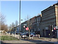
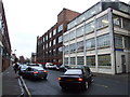
100 photos from this area
Area Information
Key information about the N19 4RN including its size, population, and administrative classification.
- Area Type
- Postcode
- Area Size
- 1.2 hectares
- Population
- 1861
- Population Density
- 13089 people/km²
House Prices in N19 4RN
60
Properties
£1,294,846
Average Sold Price
£150,000
Lowest Price
£2,146,500
Highest Price
Showing 60 properties
| Address | Type | Beds | Baths | Last Sale Price | Last Sale Date | |
|---|---|---|---|---|---|---|
| 19 Yerbury Road, London, N19 4RN | Terraced | 2 | 2 | £1,841,000 | Jan 2025 | |
| 33 Yerbury Road, London, N19 4RN | house | - | - | £2,146,500 | Feb 2024 | |
| 15 Yerbury Road, London, N19 4RN | Terraced | 5 | 2 | £1,706,500 | Oct 2020 | |
| 53 Yerbury Road, London, N19 4RN | house | 4 | 2 | £1,600,000 | Mar 2020 | |
| 55 Yerbury Road, London, N19 4RN | house | 7 | 1 | £1,560,000 | Feb 2020 | |
| 51 Yerbury Road, London, N19 4RN | Terraced | 6 | 2 | £1,390,000 | Jun 2018 | |
| 1 Yerbury Road, London, N19 4RN | Terraced | 1 | 1 | £1,750,000 | Jul 2016 | |
| 25 Yerbury Road, London, N19 4RN | Terraced | 1 | 1 | £1,650,000 | Jun 2015 | |
| 47 Yerbury Road, London, N19 4RN | Terraced | 5 | 1 | £1,300,000 | Dec 2014 | |
| 5 Yerbury Road, London, N19 4RN | Terraced | - | - | £695,000 | Mar 2009 |
Page 1 of 6
Energy Efficiency in N19 4RN
Amenities
Schools
| Rank | School | Type | Entry gender | Ages |
|---|
Explore more schools in this area
Go to Schools tabDemographics
Household Size
Two person
most common
Accommodation Type
Flats
most common
Tenure
47
majority
Ethnic Group
White
most common
Religion
N/A
most common
Household Composition
N/A
most common
Age
47
median
Adults (30-64 years)
most common
Household Deprivation
N/A
with no deprivation
NS-SEC
54
in Lower managerial occupations
Explore more demographic insights in this area
Go to Demographics tabPlanning
Planning Constraints
- Flood RiskPremium
- Ramsar Wetland SitesPremium
- Area of Outstanding Natural BeautyPremium
- Protected Nature ReservePremium
- Protected WoodlandPremium