Area Overview for N19 4NE
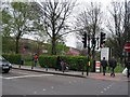
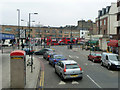
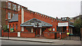
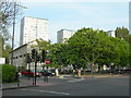
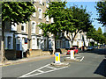
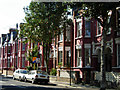
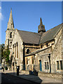
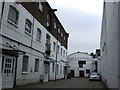
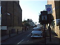
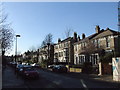
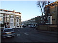
Photos of N19 4NE

Area Information
Living in N19 4NE offers a compact, residential experience shaped by its small cluster of homes and proximity to essential services. With a population of 1,705, the area is a tight-knit community where daily life revolves around nearby amenities and transport links. The demographic profile suggests a mature population, with a median age of 47 and the majority of residents falling within the 30–64 age range. This reflects a neighbourhood where adults predominate, likely balancing work and family life. The area’s housing stock is largely composed of flats, with only 20% of homes owned by residents, indicating a rental-focused market. Despite its modest size, N19 4NE is well-connected, with access to schools, retail, and public transport. The presence of Duncombe Primary School, rated ‘good’ by Ofsted, adds to its appeal for families. While the area lacks expansive green spaces or natural constraints, its practicality and accessibility make it a viable option for those prioritising convenience over sprawling landscapes.
- Area Type
- Postcode
- Area Size
- Not available
- Population
- 1705
- Population Density
- 18492 people/km²
The property market in N19 4NE is characterised by a low home ownership rate, with only 20% of properties owned by residents. This points to a rental-dominated market, where flats are the predominant housing type. The small size of the area means the housing stock is limited, and buyers may find opportunities constrained to a few specific properties. The focus on flats suggests a need for space-efficient living, which could appeal to those prioritising proximity to amenities over larger homes. For buyers, this implies a competitive market with limited options, particularly for owner-occupiers. The area’s compact nature also means that immediate surroundings are critical—potential buyers should consider nearby zones for a broader selection. While the rental market may offer flexibility, the low ownership rate could indicate a lack of long-term investment in the area’s property values.
House Prices in N19 4NE
No properties found in this postcode.
Energy Efficiency in N19 4NE
The lifestyle in N19 4NE is defined by its proximity to a range of amenities. Retail options include major chains such as Tesco Hornsey, Co-op Holloway, and Sainsburys London, ensuring easy access to groceries and daily essentials. For transport, the area is served by multiple rail and metro stations, including Upper Holloway, Crouch Hill, and Arsenal, which connect to wider London. Ferry stops like Camden Lock Waterbus and Blackfriars Pier add flexibility for those reliant on water transport. Bus services from Green Line Coach Station and Victoria Coach Station provide further connectivity. While the area lacks expansive parks or leisure facilities, its density of shops, transport, and services supports a practical, convenience-driven lifestyle. The mix of retail, transport, and public services suggests a community focused on accessibility rather than sprawling recreational spaces.
Amenities
Schools
The nearest school to N19 4NE is Duncombe Primary School, which serves the local community with a ‘good’ Ofsted rating. As a primary school, it caters to younger children, but no secondary schools are listed in the data. This means families with older children may need to look beyond the immediate area for secondary education. The presence of a well-rated primary school is a positive factor for those prioritising early education, but the absence of secondary options could be a consideration for households planning long-term. The school’s rating suggests a standard of teaching and facilities that meet acceptable benchmarks, though further details on curriculum or extracurriculars are not provided.
| Rank | School | Type | Entry gender | Ages |
|---|
Explore more schools in this area
Go to Schools tabDemographics
The community in N19 4NE is predominantly composed of adults aged 30–64, with a median age of 47. This suggests a population largely in their prime working years, potentially influencing the area’s character and local services. Home ownership is low, with only 20% of residents owning their homes, indicating a reliance on rental properties. The accommodation type is almost entirely flats, which aligns with the area’s compact nature. The predominant ethnic group is White, though no further breakdown of diversity is provided. The absence of specific data on deprivation means the quality of life cannot be fully contextualised, but the demographic profile suggests a stable, middle-aged population. This may translate to a community with established routines and a focus on practical living, rather than rapid change or youthful dynamism.
Household Size
Accommodation Type
Tenure
Ethnic Group
Religion
Household Composition
Age
Household Deprivation
NS-SEC
Explore more demographic insights in this area
Go to Demographics tabPlanning
Planning Constraints
- Flood RiskPremium
- Ramsar Wetland SitesPremium
- Area of Outstanding Natural BeautyPremium
- Protected Nature ReservePremium
- Protected WoodlandPremium