Area Overview for N19 4LW
Photos of N19 4LW
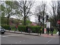
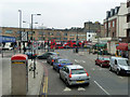
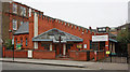
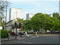
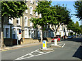
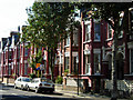
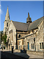
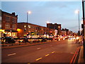
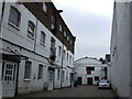
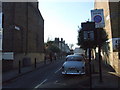
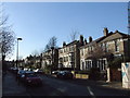
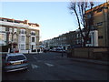
100 photos from this area
Area Information
Key information about the N19 4LW including its size, population, and administrative classification.
- Area Type
- Postcode
- Area Size
- 2368 m²
- Population
- 1913
- Population Density
- 14581 people/km²
House Prices in N19 4LW
24
Properties
£454,917
Average Sold Price
£80,000
Lowest Price
£835,000
Highest Price
Showing 24 properties
| Address | Type | Beds | Baths | Last Sale Price | Last Sale Date | |
|---|---|---|---|---|---|---|
| 70 Kingsdown Road, London, N19 4LW | Terraced | 3 | 1 | £650,000 | Nov 2023 | |
| 72 Kingsdown Road, London, N19 4LW | Detached | 4 | 1 | £640,000 | May 2020 | |
| 64 Kingsdown Road, London, N19 4LW | Terraced | 4 | 2 | £835,000 | May 2018 | |
| 66 Kingsdown Road, London, N19 4LW | house | - | - | £407,500 | Apr 2006 | |
| 78 Kingsdown Road, London, N19 4LW | Terraced | - | - | £117,000 | Sep 1997 | |
| 74 Kingsdown Road, London, N19 4LW | Terraced | 3 | 2 | £80,000 | Nov 1995 | |
| Flat A, 62 Kingsdown Road, London, N19 4LW | Block of Flats | 3 | - | - | - | |
| Flat B, 62 Kingsdown Road, London, N19 4LW | Flat | - | - | - | - | |
| First Floor Flat, 82 Kingsdown Road, London, N19 4LW | Flat | - | - | - | - | |
| Ground Floor Flat, 82 Kingsdown Road, London, N19 4LW | Flat | - | - | - | - |
Page 1 of 3
Energy Efficiency in N19 4LW
Amenities
Schools
| Rank | School | Type | Entry gender | Ages |
|---|
Explore more schools in this area
Go to Schools tabDemographics
Household Size
Two person
most common
Accommodation Type
Flats
most common
Tenure
34
majority
Ethnic Group
White
most common
Religion
N/A
most common
Household Composition
N/A
most common
Age
47
median
Adults (30-64 years)
most common
Household Deprivation
N/A
with no deprivation
NS-SEC
47
in Lower managerial occupations
Explore more demographic insights in this area
Go to Demographics tabPlanning
Planning Constraints
- Flood RiskPremium
- Ramsar Wetland SitesPremium
- Area of Outstanding Natural BeautyPremium
- Protected Nature ReservePremium
- Protected WoodlandPremium