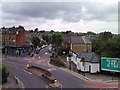
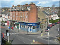
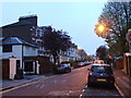
Area Overview for N19 3YU
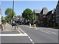
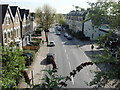
Photos of N19 3YU


Area Information
N19 3YU is a compact residential postcode in England, covering just 3,532 square metres and home to 1,736 residents. Its high population density of 491,524 people per square kilometre reflects a tightly clustered community, typical of urban or semi-urban settings. This area is defined by its small-scale living, with a focus on proximity to amenities and transport. Daily life here is shaped by its location, offering access to a mix of retail, education, and transport hubs. The area’s character is influenced by its limited size, meaning residents are likely to interact closely with their immediate surroundings. While it lacks expansive green spaces, its connectivity to nearby stations and services makes it a practical choice for those prioritising convenience. The demographic profile suggests a mature population, with a median age of 47, indicating a community of established professionals and families. Living in N19 3YU means navigating a dense, well-serviced environment where every resident is within walking distance of key facilities.
- Area Type
- Postcode
- Area Size
- 3532 m²
- Population
- 1736
- Population Density
- 14552 people/km²
The property market in N19 3YU is characterised by a high proportion of rental flats, with only 16% of homes owned by residents. This suggests a rental-dominated market, likely driven by the area’s compact size and limited availability of owner-occupied properties. The prevalence of flats indicates a focus on high-density living, which is typical in urban postcode areas. For buyers, this means opportunities for purchase are limited, with most properties available on the rental market. The small area size further restricts housing stock, making competition for available properties intense. Those seeking owner-occupation may need to look beyond N19 3YU’s immediate boundaries. The market’s structure also implies that property values are influenced by proximity to transport links and amenities, which are abundant in the area. Buyers should consider the long-term viability of investing in a rental-heavy market with limited scope for equity growth.
House Prices in N19 3YU
No properties found in this postcode.
Energy Efficiency in N19 3YU
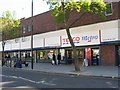
Living in N19 3YU offers access to a range of amenities within practical reach. Retail options include major chains like M&S Crouch End and Sainsburys London, providing convenience for shopping and daily essentials. The area’s transport links are complemented by proximity to leisure facilities, with ferry stops near London Zoo and Little Venice, offering recreational opportunities. Nearby rail and metro stations, such as Finsbury Park and Arsenal, facilitate easy access to cultural and commercial centres. The presence of multiple bus routes, including the Green Line Coach Station, adds to the area’s connectivity. While the small postcode size limits expansive parks, the surrounding area likely includes green spaces accessible via public transport. The mix of retail, transport, and leisure options creates a dynamic lifestyle, ideal for those prioritising convenience and accessibility over large-scale amenities.
Amenities
Schools
The schools near N19 3YU include Margaret McMillan Nursery School, which provides early education, and two independent schools: Classes Francophones De Londres and Beehive School. These institutions cater to a range of educational needs, from nursery care to independent schooling. The presence of independent schools may appeal to families seeking alternative educational pathways, though no Ofsted ratings are available to assess their quality. The nursery school supports young children, while the independent options may offer specialised curricula or smaller class sizes. However, the lack of state schools in the area could be a consideration for families prioritising public education. The mix of school types reflects a community with diverse educational preferences, though buyers should verify current school performance and accessibility for their specific needs.
| Rank | School | Type | Entry gender | Ages |
|---|
Explore more schools in this area
Go to Schools tabDemographics
The population of N19 3YU is predominantly adults aged 30–64, with a median age of 47. This suggests a community of middle-aged individuals, many of whom may be in their peak working years or raising families. Home ownership is low, at just 16%, indicating that most residents are renters. The accommodation type is primarily flats, reflecting a high-density housing model suited to urban living. The predominant ethnic group is White, though no specific data on diversity or deprivation levels is provided. The age profile implies a stable, possibly family-oriented population, though the lack of younger residents may affect local schools and community dynamics. For buyers, this demographic suggests a market skewed toward rental properties, with limited opportunities for owner-occupation. The area’s compact size and high population density further reinforce its role as a residential hub for those prioritising proximity to services over space.
Household Size
Accommodation Type
Tenure
Ethnic Group
Religion
Household Composition
Age
Household Deprivation
NS-SEC
Explore more demographic insights in this area
Go to Demographics tabPlanning
Planning Constraints
- Flood RiskPremium
- Ramsar Wetland SitesPremium
- Area of Outstanding Natural BeautyPremium
- Protected Nature ReservePremium
- Protected WoodlandPremium