Area Overview for N19 3UL
Photos of N19 3UL


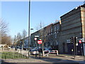
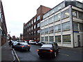
100 photos from this area
Area Information
Key information about the N19 3UL including its size, population, and administrative classification.
- Area Type
- Postcode
- Area Size
- 8016 m²
- Population
- 1549
- Population Density
- 12583 people/km²
House Prices in N19 3UL
75
Properties
£293,494
Average Sold Price
£145,000
Lowest Price
£480,000
Highest Price
Showing 75 properties
| Address | Type | Beds | Baths | Last Sale Price | Last Sale Date | |
|---|---|---|---|---|---|---|
| 39 Henfield Close, London, N19 3UL | Maisonette | 1 | 1 | £454,000 | Aug 2021 | |
| 43 Henfield Close, London, N19 3UL | Maisonette | - | - | £480,000 | Jun 2021 | |
| 105 Henfield Close, London, N19 3UL | Flat | 1 | 1 | £300,000 | Jun 2021 | |
| 40 Henfield Close, London, N19 3UL | Maisonette | - | - | £468,000 | Aug 2019 | |
| 31 Henfield Close, London, N19 3UL | Maisonette | 3 | 1 | £365,000 | Nov 2018 | |
| 47 Henfield Close, London, N19 3UL | Maisonette | 4 | 2 | £387,000 | Jun 2015 | |
| 52 Henfield Close, London, N19 3UL | Maisonette | 3 | 1 | £395,000 | Dec 2014 | |
| 37 Henfield Close, London, N19 3UL | Maisonette | 3 | - | £330,000 | Dec 2013 | |
| 97 Henfield Close, London, N19 3UL | Flat | - | - | £249,950 | Oct 2013 | |
| 55 Henfield Close, London, N19 3UL | Flat | - | - | £320,000 | Sep 2013 |
Page 1 of 8
Energy Efficiency in N19 3UL
Amenities
Schools
| Rank | School | Type | Entry gender | Ages |
|---|
Explore more schools in this area
Go to Schools tabDemographics
Household Size
Family (3-5 people)
most common
Accommodation Type
Flats
most common
Tenure
47
majority
Ethnic Group
White
most common
Religion
N/A
most common
Household Composition
N/A
most common
Age
47
median
Adults (30-64 years)
most common
Household Deprivation
N/A
with no deprivation
NS-SEC
50
in Lower managerial occupations
Explore more demographic insights in this area
Go to Demographics tabPlanning
Planning Constraints
- Flood RiskPremium
- Ramsar Wetland SitesPremium
- Area of Outstanding Natural BeautyPremium
- Protected Nature ReservePremium
- Protected WoodlandPremium