Area Overview for N19 3SP
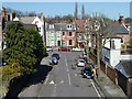
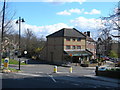
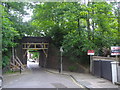
Photos of N19 3SP


Area Information
Living in N19 3SP means being part of a tightly knit residential cluster with a population of 1,319. The area is characterised by its compact size and proximity to a range of amenities, making it practical for daily life. With a median age of 47, the community is predominantly composed of adults aged 30–64, suggesting a mature, stable demographic. The area’s small footprint means it is likely to feel quiet and close-knit, though its position near transport hubs like Crouch Hill Station and Upper Holloway Station offers easy access to London’s broader network. Residents benefit from a mix of retail options, including M&S Crouch End and Sainsburys, alongside public transport links that span rail, metro, and bus routes. While the area has no major planning constraints, it carries a medium crime risk, which should be considered alongside its otherwise low environmental hazards. For those seeking a balance between convenience and a manageable community scale, N19 3SP offers a distinct blend of practicality and accessibility.
- Area Type
- Postcode
- Area Size
- Not available
- Population
- 1319
- Population Density
- 13446 people/km²
The property market in N19 3SP is defined by its low home ownership rate of 23%, which indicates a rental-dominated landscape. The predominant accommodation type is flats, suggesting a housing stock tailored to smaller households or those seeking urban living. This configuration means the area is less likely to attract first-time buyers looking for owner-occupied properties, and more suited to renters or those considering short-term stays. Given the small population and compact size of the area, the housing stock is likely limited, with buyers needing to consider nearby zones for more options. The focus on flats also implies a higher demand for apartments in surrounding areas, potentially influencing property trends in adjacent postcode clusters. For those seeking a flat in N19 3SP, the market may offer a mix of established properties, though availability could be constrained by the area’s size.
House Prices in N19 3SP
No properties found in this postcode.
Energy Efficiency in N19 3SP
The lifestyle in N19 3SP is shaped by its proximity to a variety of amenities. Retail options include major chains like M&S Crouch End, Sainsburys, and Tesco, ensuring daily essentials are easily accessible. The area’s transport links extend beyond commuting, with ferry services such as the London Zoo Waterbus Stop offering scenic travel options. While specific parks or leisure venues are not listed in the data, the presence of multiple transport hubs suggests access to nearby green spaces or cultural attractions. The mix of retail, transport, and connectivity options contributes to a convenient, urban lifestyle, ideal for those who value accessibility and practicality. The area’s compact nature means amenities are likely to be within walking or short transit distance, enhancing the overall quality of daily life.
Amenities
Schools
The nearest school to N19 3SP is Ashmount Primary School, which is rated 'good' by Ofsted. As a primary school, it serves families with young children, though no secondary schools are listed in the data. The presence of a single primary school suggests that families may need to look beyond the immediate area for secondary education options. The 'good' rating indicates a satisfactory standard of teaching and facilities, which is a positive factor for parents prioritising quality education. However, the absence of secondary schools nearby means that students may need to commute to other parts of London for further education. This dynamic should be considered when evaluating the long-term suitability of N19 3SP for families with children of varying ages.
| Rank | School | Type | Entry gender | Ages |
|---|
Explore more schools in this area
Go to Schools tabDemographics
The community in N19 3SP is predominantly composed of adults aged 30–64, with a median age of 47. Home ownership here is relatively low, at 23%, indicating that most residents are likely to be renters. The accommodation type is primarily flats, reflecting a housing stock suited to smaller households or those prioritising convenience over larger properties. The predominant ethnic group is White, though specific data on diversity or deprivation is not provided. The age profile suggests a mature population, which may influence local services and amenities. With 23% of residents owning their homes, the area is more aligned with rental markets than owner-occupied communities. This dynamic could affect property values and the types of housing available, particularly in a small area where demand for flats may be higher.
Household Size
Accommodation Type
Tenure
Ethnic Group
Religion
Household Composition
Age
Household Deprivation
NS-SEC
Explore more demographic insights in this area
Go to Demographics tabPlanning
Planning Constraints
- Flood RiskPremium
- Ramsar Wetland SitesPremium
- Area of Outstanding Natural BeautyPremium
- Protected Nature ReservePremium
- Protected WoodlandPremium