Area Overview for N19 3NZ
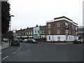
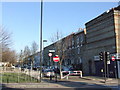
Photos of N19 3NZ


Area Information
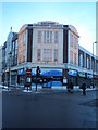
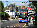
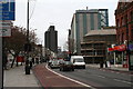
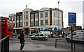
Living in N19 3NZ means being part of a compact, residential postcode in England with a population of just 1,698 people. This small cluster of homes is characterised by a mature community, with the majority of residents aged between 30 and 64. The area is well-served by transport links, including multiple rail, metro, and bus routes, making it easy to access central London or nearby suburbs. Daily life here is shaped by proximity to retail hubs like Sainsburys Archway and Co-op Holloway, as well as ferry services to landmarks such as London Zoo. While the housing stock is predominantly flats, the area’s small size means it is tightly knit, with a focus on practical living. The low flood risk and absence of environmental constraints like protected woodlands or AONB designations suggest a straightforward, unobstructed lifestyle. For those seeking a balance between urban convenience and residential calm, N19 3NZ offers a compact, functional base with clear access to essential services and transport networks.
- Area Type
- Postcode
- Area Size
- Not available
- Population
- 1698
- Population Density
- 19100 people/km²
The property market in N19 3NZ is defined by its low home ownership rate of 30%, indicating that the area is more of a rental market than an owner-occupied one. The predominant accommodation type is flats, which may suggest a mix of older residential blocks and newer developments. This configuration is typical of smaller postcode areas where housing is concentrated and less varied. For buyers, this means limited opportunities for purchasing owner-occupied homes, with the market likely dominated by landlords or investors. The small size of the area also means that property options are limited to the immediate vicinity, requiring buyers to consider nearby postcodes for more choice. The focus on flats may appeal to those seeking low-maintenance living, but it also underscores the area’s role as a secondary housing option rather than a primary market for homebuyers.
House Prices in N19 3NZ
No properties found in this postcode.
Energy Efficiency in N19 3NZ
The lifestyle in N19 3NZ is shaped by its proximity to a range of amenities within practical reach. Retail options include Co-op Holloway, Sainsburys Archway, and Aldi Archway, offering everyday shopping needs. The area’s transport links also serve as gateways to leisure activities, with ferry services connecting to landmarks like London Zoo and Little Venice. While the residential cluster itself is small, its integration with nearby transport hubs means residents can access broader urban amenities. The presence of multiple rail, metro, and bus stops ensures that dining, entertainment, and cultural opportunities in surrounding areas are easily reachable. This combination of local convenience and broader connectivity creates a lifestyle that balances self-sufficiency with urban accessibility, ideal for those prioritising practicality and ease of movement.
Amenities
Schools
| Rank | School | Type | Entry gender | Ages |
|---|
Explore more schools in this area
Go to Schools tabDemographics
The community in N19 3NZ is predominantly composed of adults aged 30 to 64, with a median age of 47. This suggests a mature, stable population, likely with established careers and families. Home ownership is relatively low at 30%, indicating that a significant proportion of residents rent their homes, which may reflect the area’s focus on purpose-built flats. The accommodation type is largely flats, which aligns with the lower home ownership rate and suggests a mix of older housing stock and newer developments. The predominant ethnic group is White, though no specific data on diversity or deprivation is provided. The age profile and ownership figures imply a community that may prioritise convenience and accessibility over long-term property investment. With no data on deprivation levels, it is unclear how economic factors influence quality of life, but the demographic stability suggests a consistent, low-turnover environment.
Household Size
Accommodation Type
Tenure
Ethnic Group
Religion
Household Composition
Age
Household Deprivation
NS-SEC
Explore more demographic insights in this area
Go to Demographics tabPlanning
Planning Constraints
- Flood RiskPremium
- Ramsar Wetland SitesPremium
- Area of Outstanding Natural BeautyPremium
- Protected Nature ReservePremium
- Protected WoodlandPremium